Union geodata
Union (Illinois) is a populated place; located in United States in America/Chicago (GMT-5) time zone. With population of 558 people, there are 20177 cities with bigger population in this country. Compared to other cities in United States, 77.6% of cities are located further ↓South; 54.9% of cities are located further →East and 63.7% of cities have lower elevation than Union. Note1


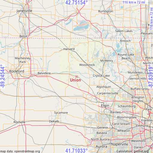
Union GPS coordinates[2]
42° 13' 59.088" North, 88° 32' 32.316" West
| Map corner | latitude | longitude |
|---|---|---|
| Upper-left | 42.75154°, | -89.24544° |
| Center: | 42.23308°, | -88.54231° |
| Lower-right: | 41.71033°, | -87.83919° |
| Map W x H: | 115.8×115.8 km | = 72×72mi |
| max Lat: | 71.29058° ⇑22.4% North |
| Union: | 42.23308° |
| min Lat: | ⇓77.6% South 19.06759° |
| min Long | Union | max Long |
| -171.73463° | -88.54231° | -66.98998° |
| W 45.1%⇐ | ⇒54.9% E |
Elevation
Elevation of Union is 256 m = 840 ft, and this is 38.8 m = 127 ft below average elevation for this country.
| Max E: |
3189 m = 10463 ft | 36.3% |
| Avg. | 294.8 m = 967 ft | |
| Union | 256 m = 840 ft | |
Min E: |
-60 m = -197 ft | 63.7% |
See also: United States elevation on elevation.city.
Geographical zone
Union is located in North temperate zone (between Tropic of Cancer and the Arctic Circle). Distance of this Northern Tropic circle is 2090 km =1298.7 mi to South.| Distance of | km | miles | from Union |
|---|---|---|---|
| North Pole | 5311.2 | 3300.2 | to North |
| Arctic Circle | 2705.3 | 1681 | to North |
| Tropic Cancer | 2090 | 1298.7 | to South |
| Equator | 4695.9 | 2917.9 | to South |


Nearby cities:
15 places around Union: (largest is in red/bold)
• Algonquin
21.8 km =13.5 mi,  110°
110°
• Bull Valley
18.2 km =11.3 mi,  57°
57°
• Burlington
20.1 km =12.5 mi,  181°
181°
• Crystal Lake
18.6 km =11.6 mi,  87°
87°
• Genoa
19.5 km =12.1 mi,  219°
219°
• Gilberts
20.1 km =12.5 mi,  135°
135°
• Hampshire
15.1 km =9.4 mi, 176°
• Harvard
21.8 km =13.5 mi,  344°
344°
• Huntley
11.9 km =7.4 mi,  127°
127°
• Kingston
23.2 km =14.4 mi,  230°
230°
• Lake in the Hills
18.4 km =11.4 mi, 108°
• Lakewood
15.4 km =9.6 mi, 91°
• Marengo
5.7 km =3.5 mi,  287°
287°
• Pingree Grove
21.1 km =13.1 mi,  149°
149°
• Woodstock
11.9 km =7.4 mi,  40°
40°
Sources, notices
• [Note1] Compared only with cities in United States existing in our database
• [Src1] Map data: © OpenStreetMap contributors (CC-BY-SA)
• [Src2] Other city data from geonames.org with taken over terms of usage.
• [Src3] Geographical zone / Annual Mean Temperature by Robert A. Rohde @ Wikipedia
