Wheatfield geodata
Wheatfield (Indiana) is a populated place; located in United States in America/Chicago (GMT-5) time zone. With population of 845 people, there are 17406 cities with bigger population in this country. Compared to other cities in United States, 67.8% of cities are located further ↓South; 50.1% of cities are located further ←West and 50.7% of cities have lower elevation than Wheatfield. Note1


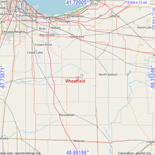
Wheatfield GPS coordinates[2]
41° 11' 35.124" North, 87° 3' 20.088" West
| Map corner | latitude | longitude |
|---|---|---|
| Upper-left | 41.72005°, | -87.75871° |
| Center: | 41.19309°, | -87.05558° |
| Lower-right: | 40.66186°, | -86.35246° |
| Map W x H: | 117.7×117.7 km | = 73.1×73.1mi |
| max Lat: | 71.29058° ⇑32.2% North |
| Wheatfield: | 41.19309° |
| min Lat: | ⇓67.8% South 19.06759° |
| min Long | Wheatfield | max Long |
| -171.73463° | -87.05558° | -66.98998° |
| W 50.1%⇐ | ⇒49.9% E |
Elevation
Elevation of Wheatfield is 201 m = 659 ft, and this is 93.8 m = 308 ft below average elevation for this country.
| Max E: |
3189 m = 10463 ft | 49.3% |
| Avg. | 294.8 m = 967 ft | |
| Wheatfield | 201 m = 659 ft | |
Min E: |
-60 m = -197 ft | 50.7% |
See also: United States elevation on elevation.city.
Geographical zone
Wheatfield is located in North temperate zone (between Tropic of Cancer and the Arctic Circle). Distance of this Northern Tropic circle is 1974.3 km =1226.8 mi to South.| Distance of | km | miles | from Wheatfield |
|---|---|---|---|
| North Pole | 5426.8 | 3372.1 | to North |
| Arctic Circle | 2820.9 | 1752.8 | to North |
| Tropic Cancer | 1974.3 | 1226.8 | to South |
| Equator | 4580.2 | 2846 | to South |


Nearby cities:
15 places around Wheatfield: (largest is in red/bold)
• Aberdeen
27.7 km =17.2 mi,  350°
350°
• DeMotte
12 km =7.5 mi,  271°
271°
• Francesville
27.4 km =17 mi,  147°
147°
• Hebron
18.5 km =11.5 mi,  319°
319°
• Kouts
14 km =8.7 mi,  10°
10°
• La Crosse
19.5 km =12.1 mi,  44°
44°
• Lakes of the Four Seasons
27.5 km =17.1 mi,  331°
331°
• Medaryville
18.6 km =11.6 mi,  132°
132°
• North Judson
23.5 km =14.6 mi,  84°
84°
• Rensselaer
29.6 km =18.4 mi,  195°
195°
• Roselawn
22.4 km =13.9 mi,  255°
255°
• Shelby
24.5 km =15.2 mi, 270°
• Shorewood Forest
30.9 km =19.2 mi, 346°
• Wanatah
29.5 km =18.3 mi,  26°
26°
• Winfield
29.9 km =18.6 mi, 322°
Sources, notices
• [Note1] Compared only with cities in United States existing in our database
• [Src1] Map data: © OpenStreetMap contributors (CC-BY-SA)
• [Src2] Other city data from geonames.org with taken over terms of usage.
• [Src3] Geographical zone / Annual Mean Temperature by Robert A. Rohde @ Wikipedia
