Huntington geodata
Huntington (Massachusetts) is a populated place; located in United States in America/New_York (GMT-4) time zone. With population of 936 people, there are 16749 cities with bigger population in this country. Compared to other cities in United States, 77.6% of cities are located further ↓South; 94.1% of cities are located further ←West and 64.7% of cities have higher elevation than Huntington. Note1
Administrative division(s):
- Level 1: Massachusetts
- Level 2: Hampshire County
- Level 3: Town of Huntington


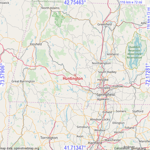
Huntington GPS coordinates[2]
42° 14' 10.32" North, 72° 52' 33.348" West
| Map corner | latitude | longitude |
|---|---|---|
| Upper-left | 42.75463°, | -73.57906° |
| Center: | 42.2362°, | -72.87593° |
| Lower-right: | 41.71347°, | -72.17281° |
| Map W x H: | 115.8×115.8 km | = 72×72mi |
| max Lat: | 71.29058° ⇑22.4% North |
| Huntington: | 42.2362° |
| min Lat: | ⇓77.6% South 19.06759° |
| min Long | Huntington | max Long |
| -171.73463° | -72.87593° | -66.98998° |
| W 94.1%⇐ | ⇒5.9% E |
Elevation
Elevation of Huntington is 130 m = 427 ft, and this is 164.8 m = 541 ft below average elevation for this country.
| Max E: |
3189 m = 10463 ft | 64.7% |
| Avg. | 294.8 m = 967 ft | |
| Huntington | 130 m = 427 ft | |
Min E: |
-60 m = -197 ft | 35.3% |
See also: United States elevation on elevation.city.
Geographical zone
Huntington is located in North temperate zone (between Tropic of Cancer and the Arctic Circle). Distance of this Northern Tropic circle is 2090.3 km =1298.9 mi to South.| Distance of | km | miles | from Huntington |
|---|---|---|---|
| North Pole | 5310.8 | 3300 | to North |
| Arctic Circle | 2704.9 | 1680.7 | to North |
| Tropic Cancer | 2090.3 | 1298.9 | to South |
| Equator | 4696.2 | 2918.1 | to South |


Nearby cities:
15 places around Huntington: (largest is in red/bold)
• Becket
20.1 km =12.5 mi,  302°
302°
• Chester
9.7 km =6 mi, 299°
• Chesterfield
17.5 km =10.9 mi,  9°
9°
• Easthampton
17.4 km =10.8 mi,  78°
78°
• Granville
18.9 km =11.7 mi,  176°
176°
• Holyoke
21.7 km =13.5 mi,  99°
99°
• Middlefield
16.9 km =10.5 mi,  317°
317°
• Montgomery
6.7 km =4.2 mi,  119°
119°
• Northampton
21.7 km =13.5 mi,  62°
62°
• Otis
18.4 km =11.4 mi,  254°
254°
• Russell
5.3 km =3.3 mi,  165°
165°
• Southampton
12 km =7.5 mi,  93°
93°
• Westfield
16.2 km =10.1 mi,  139°
139°
• Westhampton
11.2 km =7 mi,  48°
48°
• Williamsburg
21.2 km =13.2 mi,  34°
34°
Sources, notices
• [Note1] Compared only with cities in United States existing in our database
• [Src1] Map data: © OpenStreetMap contributors (CC-BY-SA)
• [Src2] Other city data from geonames.org with taken over terms of usage.
• [Src3] Geographical zone / Annual Mean Temperature by Robert A. Rohde @ Wikipedia
