Rutland geodata
Rutland (Massachusetts) is a populated place; located in United States in America/New_York (GMT-4) time zone. With population of 2,111 people, there are 11584 cities with bigger population in this country. Compared to other cities in United States, 78.7% of cities are located further ↓South; 95.8% of cities are located further ←West and 79.3% of cities have lower elevation than Rutland. Note1
Administrative division(s):
- Level 1: Massachusetts
- Level 2: Worcester County
- Level 3: Town of Rutland


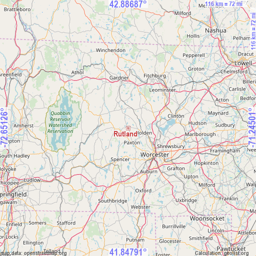
Rutland GPS coordinates[2]
42° 22' 10.344" North, 71° 56' 53.268" West
| Map corner | latitude | longitude |
|---|---|---|
| Upper-left | 42.88687°, | -72.65126° |
| Center: | 42.36954°, | -71.94813° |
| Lower-right: | 41.84791°, | -71.24501° |
| Map W x H: | 115.5×115.5 km | = 71.8×71.8mi |
| max Lat: | 71.29058° ⇑21.3% North |
| Rutland: | 42.36954° |
| min Lat: | ⇓78.7% South 19.06759° |
| min Long | Rutland | max Long |
| -171.73463° | -71.94813° | -66.98998° |
| W 95.8%⇐ | ⇒4.2% E |
Elevation
Elevation of Rutland is 347 m = 1138 ft, and this is 52.2 m = 171 ft above average elevation for this country.
| Max E: |
3189 m = 10463 ft | 20.7% |
| Rutland | 347 m 1138 ft | |
| Avg. | 294.8 m = 967 ft | |
Min E: |
-60 m = -197 ft | 79.3% |
See also: United States elevation on elevation.city.
Geographical zone
Rutland is located in North temperate zone (between Tropic of Cancer and the Arctic Circle). Distance of this Northern Tropic circle is 2105.1 km =1308 mi to South.| Distance of | km | miles | from Rutland |
|---|---|---|---|
| North Pole | 5296 | 3290.8 | to North |
| Arctic Circle | 2690.1 | 1671.6 | to North |
| Tropic Cancer | 2105.1 | 1308 | to South |
| Equator | 4711.1 | 2927.3 | to South |


Nearby cities:
15 places around Rutland: (largest is in red/bold)
• Barre
14.2 km =8.8 mi,  294°
294°
• East Brookfield
17.7 km =11 mi,  207°
207°
• Hamilton Worcester
19.5 km =12.1 mi,  130°
130°
• Holden
7.2 km =4.5 mi,  105°
105°
• Hubbardston
12.5 km =7.8 mi,  337°
337°
• Leicester
14.1 km =8.8 mi,  166°
166°
• New Braintree
15.7 km =9.8 mi,  248°
248°
• North Brookfield
15.9 km =9.9 mi,  224°
224°
• Oakham
8.2 km =5.1 mi,  256°
256°
• Paxton
6.7 km =4.2 mi, 165°
• Princeton
10.5 km =6.5 mi,  33°
33°
• Spencer
14.4 km =8.9 mi,  194°
194°
• Sterling
17.2 km =10.7 mi,  63°
63°
• West Boylston
13.4 km =8.3 mi,  91°
91°
• Worcester
16.9 km =10.5 mi, 134°
Sources, notices
• [Note1] Compared only with cities in United States existing in our database
• [Src1] Map data: © OpenStreetMap contributors (CC-BY-SA)
• [Src2] Other city data from geonames.org with taken over terms of usage.
• [Src3] Geographical zone / Annual Mean Temperature by Robert A. Rohde @ Wikipedia
