Cumberland Center geodata
Cumberland Center (Maine) is a populated place; located in United States in America/New_York (GMT-4) time zone. With population of 2,499 people, there are 10612 cities with bigger population in this country. Compared to other cities in United States, 87.6% of cities are located further ↓South; 98.6% of cities are located further ←West and 77.7% of cities have higher elevation than Cumberland Center. Note1


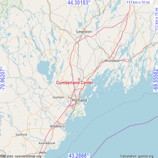
Cumberland Center GPS coordinates[2]
43° 47' 47.292" North, 70° 15' 32.184" West
| Map corner | latitude | longitude |
|---|---|---|
| Upper-left | 44.30183°, | -70.96207° |
| Center: | 43.79647°, | -70.25894° |
| Lower-right: | 43.2868°, | -69.55582° |
| Map W x H: | 112.9×112.9 km | = 70.2×70.2mi |
| max Lat: | 71.29058° ⇑12.4% North |
| Cumberland Center: | 43.79647° |
| min Lat: | ⇓87.6% South 19.06759° |
| min Long | Cumberland Cent | max Long |
| -171.73463° | -70.25894° | -66.98998° |
| W 98.6%⇐ | ⇒1.4% E |
Elevation
Elevation of Cumberland Center is 57 m = 187 ft, and this is 237.8 m = 780 ft below average elevation for this country.
| Max E: |
3189 m = 10463 ft | 77.7% |
| Avg. | 294.8 m = 967 ft | |
| Cumberland Center | 57 m = 187 ft | |
Min E: |
-60 m = -197 ft | 22.3% |
See also: United States elevation on elevation.city.
Geographical zone
Cumberland Center is located in North temperate zone (between Tropic of Cancer and the Arctic Circle). Distance of this Northern Tropic circle is 2263.8 km =1406.7 mi to South.| Distance of | km | miles | from Cumberland Center |
|---|---|---|---|
| North Pole | 5137.4 | 3192.2 | to North |
| Arctic Circle | 2531.5 | 1573 | to North |
| Tropic Cancer | 2263.8 | 1406.7 | to South |
| Equator | 4869.7 | 3025.9 | to South |


Nearby cities:
15 places around Cumberland Center: (largest is in red/bold)
• Falmouth
7.6 km =4.7 mi,  169°
169°
• Falmouth Foreside
8 km =5 mi,  149°
149°
• Freeport
14.2 km =8.8 mi,  61°
61°
• Gorham
19.8 km =12.3 mi,  228°
228°
• Gray
11.5 km =7.1 mi,  329°
329°
• Little Falls
15.3 km =9.5 mi,  241°
241°
• New Gloucester
18.6 km =11.6 mi,  354°
354°
• North Windham
15 km =9.3 mi,  286°
286°
• Portland
15.5 km =9.6 mi,  179°
179°
• Raymond
20.6 km =12.8 mi,  304°
304°
• South Portland
17.3 km =10.7 mi, 175°
• South Portland Gardens
18.1 km =11.2 mi,  194°
194°
• South Windham
14.8 km =9.2 mi, 243°
• Westbrook
16.1 km =10 mi,  214°
214°
• Yarmouth
5.8 km =3.6 mi,  85°
85°
Sources, notices
• [Note1] Compared only with cities in United States existing in our database
• [Src1] Map data: © OpenStreetMap contributors (CC-BY-SA)
• [Src2] Other city data from geonames.org with taken over terms of usage.
• [Src3] Geographical zone / Annual Mean Temperature by Robert A. Rohde @ Wikipedia
