Kenduskeag geodata
Kenduskeag (Maine) is a populated place; located in United States in America/New_York (GMT-4) time zone. With population of 1,217 people, there are 15030 cities with bigger population in this country. Compared to other cities in United States, 92.2% of cities are located further ↓South; 99.5% of cities are located further ←West and 82.9% of cities have higher elevation than Kenduskeag. Note1


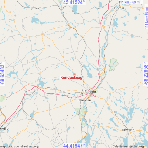
Kenduskeag GPS coordinates[2]
44° 55' 10.236" North, 68° 55' 54.12" West
| Map corner | latitude | longitude |
|---|---|---|
| Upper-left | 45.41524°, | -69.63483° |
| Center: | 44.91951°, | -68.9317° |
| Lower-right: | 44.41947°, | -68.22858° |
| Map W x H: | 110.7×110.7 km | = 68.8×68.8mi |
| max Lat: | 71.29058° ⇑7.8% North |
| Kenduskeag: | 44.91951° |
| min Lat: | ⇓92.2% South 19.06759° |
| min Long | Kenduskeag | max Long |
| -171.73463° | -68.9317° | -66.98998° |
| W 99.5%⇐ | ⇒0.5% E |
Elevation
Elevation of Kenduskeag is 35 m = 115 ft, and this is 259.8 m = 852 ft below average elevation for this country.
| Max E: |
3189 m = 10463 ft | 82.9% |
| Avg. | 294.8 m = 967 ft | |
| Kenduskeag | 35 m = 115 ft | |
Min E: |
-60 m = -197 ft | 17.1% |
See also: United States elevation on elevation.city.
Geographical zone
Kenduskeag is located in North temperate zone (between Tropic of Cancer and the Arctic Circle). Distance of this Northern Tropic circle is 2388.7 km =1484.3 mi to South.| Distance of | km | miles | from Kenduskeag |
|---|---|---|---|
| North Pole | 5012.5 | 3114.6 | to North |
| Arctic Circle | 2406.6 | 1495.4 | to North |
| Tropic Cancer | 2388.7 | 1484.3 | to South |
| Equator | 4994.6 | 3103.5 | to South |


Nearby cities:
15 places around Kenduskeag: (largest is in red/bold)
• Alton
20.2 km =12.6 mi,  52°
52°
• Bangor
17.9 km =11.1 mi,  137°
137°
• Bradford
16.4 km =10.2 mi,  358°
358°
• Brewer
19.1 km =11.9 mi, 135°
• Carmel
16.5 km =10.3 mi,  214°
214°
• Charleston
20.3 km =12.6 mi,  335°
335°
• Eddington
21.5 km =13.4 mi,  118°
118°
• Etna
17.9 km =11.1 mi,  232°
232°
• Hampden
20.8 km =12.9 mi,  158°
158°
• Hermon
12.3 km =7.6 mi,  173°
173°
• Hudson
9.9 km =6.2 mi,  23°
23°
• Levant
5.6 km =3.5 mi,  182°
182°
• Orono
20.9 km =13 mi,  101°
101°
• Stetson
16.9 km =10.5 mi,  259°
259°
• Veazie
20 km =12.4 mi, 116°
Sources, notices
• [Note1] Compared only with cities in United States existing in our database
• [Src1] Map data: © OpenStreetMap contributors (CC-BY-SA)
• [Src2] Other city data from geonames.org with taken over terms of usage.
• [Src3] Geographical zone / Annual Mean Temperature by Robert A. Rohde @ Wikipedia
