Veazie geodata
Veazie (Maine) is a populated place; located in United States in America/New_York (GMT-4) time zone. With population of 1,813 people, there are 12493 cities with bigger population in this country. Compared to other cities in United States, 91.8% of cities are located further ↓South; 99.6% of cities are located further ←West and 85.4% of cities have higher elevation than Veazie. Note1


Veazie GPS coordinates[2]
44° 50' 19.248" North, 68° 42' 19.116" West
| Map corner | latitude | longitude |
|---|---|---|
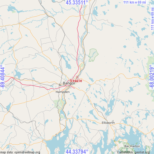
| Upper-left | 45.33511°, | -69.40844° |
| Center: | 44.83868°, | -68.70531° |
| Lower-right: | 44.33794°, | -68.00219° |
| Map W x H: | 110.9×110.9 km | = 68.9×68.9mi |
| max Lat: | 71.29058° ⇑8.2% North |
| Veazie: | 44.83868° |
| min Lat: | ⇓91.8% South 19.06759° |
| min Long | Veazie | max Long |
| -171.73463° | -68.70531° | -66.98998° |
| W 99.6%⇐ | ⇒0.40000000000001% E |
Elevation
Elevation of Veazie is 27 m = 89 ft, and this is 267.8 m = 879 ft below average elevation for this country.
| Max E: |
3189 m = 10463 ft | 85.4% |
| Avg. | 294.8 m = 967 ft | |
| Veazie | 27 m = 89 ft | |
Min E: |
-60 m = -197 ft | 14.6% |
See also: United States elevation on elevation.city.
Geographical zone
Veazie is located in North temperate zone (between Tropic of Cancer and the Arctic Circle). Distance of this Northern Tropic circle is 2379.7 km =1478.7 mi to South.| Distance of | km | miles | from Veazie |
|---|---|---|---|
| North Pole | 5021.5 | 3120.2 | to North |
| Arctic Circle | 2415.6 | 1501 | to North |
| Tropic Cancer | 2379.7 | 1478.7 | to South |
| Equator | 4985.6 | 3097.9 | to South |


Nearby cities:
15 places around Veazie: (largest is in red/bold)
• Bangor
7.1 km =4.4 mi,  233°
233°
• Bradley
11 km =6.8 mi,  33°
33°
• Brewer
6.4 km =4 mi,  223°
223°
• Clifton
15.5 km =9.6 mi,  99°
99°
• Dedham
16.7 km =10.4 mi,  168°
168°
• Eddington
1.7 km =1.1 mi,  145°
145°
• Hampden
14.7 km =9.1 mi, 224°
• Hermon
16.7 km =10.4 mi,  259°
259°
• Holden
9.8 km =6.1 mi, 167°
• Kenduskeag
20 km =12.4 mi,  296°
296°
• Levant
18.4 km =11.4 mi,  280°
280°
• Milford
12.9 km =8 mi,  22°
22°
• Old Town
11.6 km =7.2 mi, 23°
• Orono
5.6 km =3.5 mi, 27°
• Orrington
15.3 km =9.5 mi, 218°
Sources, notices
• [Note1] Compared only with cities in United States existing in our database
• [Src1] Map data: © OpenStreetMap contributors (CC-BY-SA)
• [Src2] Other city data from geonames.org with taken over terms of usage.
• [Src3] Geographical zone / Annual Mean Temperature by Robert A. Rohde @ Wikipedia
