Beecher geodata
Beecher (Michigan) is a populated place; located in United States in America/Detroit (GMT-4) time zone. With population of 10,232 people, there are 4391 cities with bigger population in this country. Compared to other cities in United States, 84% of cities are located further ↓South; 60.1% of cities are located further ←West and 61.2% of cities have lower elevation than Beecher. Note1
Administrative division(s):
- Level 1: Michigan
- Level 2: Genesee County
- Level 3: Township of Mount Morris


Beecher GPS coordinates[2]
43° 5' 24.108" North, 83° 41' 39.84" West
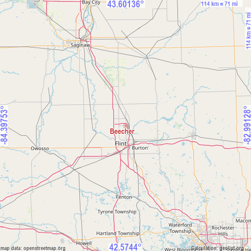
| Map corner | latitude | longitude |
|---|---|---|
| Upper-left | 43.60136°, | -84.39753° |
| Center: | 43.09003°, | -83.6944° |
| Lower-right: | 42.5744°, | -82.99128° |
| Map W x H: | 114.2×114.2 km | = 71×71mi |
| max Lat: | 71.29058° ⇑16% North |
| Beecher: | 43.09003° |
| min Lat: | ⇓84% South 19.06759° |
| min Long | Beecher | max Long |
| -171.73463° | -83.6944° | -66.98998° |
| W 60.1%⇐ | ⇒39.9% E |
Elevation
Elevation of Beecher is 245 m = 804 ft, and this is 49.8 m = 163 ft below average elevation for this country.
| Max E: |
3189 m = 10463 ft | 38.8% |
| Avg. | 294.8 m = 967 ft | |
| Beecher | 245 m = 804 ft | |
Min E: |
-60 m = -197 ft | 61.2% |
See also: United States elevation on elevation.city.
Geographical zone
Beecher is located in North temperate zone (between Tropic of Cancer and the Arctic Circle). Distance of this Northern Tropic circle is 2185.2 km =1357.8 mi to South.| Distance of | km | miles | from Beecher |
|---|---|---|---|
| North Pole | 5215.9 | 3241 | to North |
| Arctic Circle | 2610 | 1621.8 | to North |
| Tropic Cancer | 2185.2 | 1357.8 | to South |
| Equator | 4791.2 | 2977.1 | to South |


Nearby cities:
15 places around Beecher: (largest is in red/bold)
• Birch Run
19.6 km =12.2 mi,  335°
335°
• Burt
23.7 km =14.7 mi,  313°
313°
• Burton
11.9 km =7.4 mi,  147°
147°
• Clio
10.2 km =6.3 mi, 341°
• Columbiaville
24.2 km =15 mi,  72°
72°
• Davison
15.6 km =9.7 mi,  113°
113°
• Flint
8.6 km =5.3 mi,  176°
176°
• Flushing
13.1 km =8.1 mi,  256°
256°
• Grand Blanc
18.8 km =11.7 mi,  163°
163°
• Lennon
22.5 km =14 mi,  238°
238°
• Montrose
18.8 km =11.7 mi,  300°
300°
• Mount Morris
3.2 km =2 mi,  359°
359°
• New Lothrop
22.6 km =14 mi,  277°
277°
• Otisville
16.2 km =10.1 mi,  58°
58°
• Swartz Creek
18.4 km =11.4 mi,  216°
216°
Sources, notices
• [Note1] Compared only with cities in United States existing in our database
• [Src1] Map data: © OpenStreetMap contributors (CC-BY-SA)
• [Src2] Other city data from geonames.org with taken over terms of usage.
• [Src3] Geographical zone / Annual Mean Temperature by Robert A. Rohde @ Wikipedia
