East Grand Rapids geodata
East Grand Rapids (Michigan) is a populated place; located in United States in America/Detroit (GMT-4) time zone. With population of 11,311 people, there are 4083 cities with bigger population in this country. Compared to other cities in United States, 82.9% of cities are located further ↓South; 54.2% of cities are located further ←West and 58.4% of cities have lower elevation than East Grand Rapids. Note1
Administrative division(s):
- Level 1: Michigan
- Level 2: Kent County
- Level 3: City of East Grand Rapids


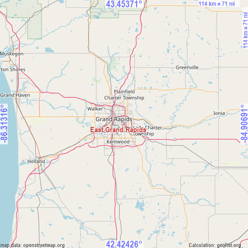
East Grand Rapids GPS coordinates[2]
42° 56' 28.104" North, 85° 36' 36.108" West
| Map corner | latitude | longitude |
|---|---|---|
| Upper-left | 43.45371°, | -86.31316° |
| Center: | 42.94114°, | -85.61003° |
| Lower-right: | 42.42426°, | -84.90691° |
| Map W x H: | 114.5×114.5 km | = 71.1×71.1mi |
| max Lat: | 71.29058° ⇑17.1% North |
| East Grand Rapids: | 42.94114° |
| min Lat: | ⇓82.9% South 19.06759° |
| min Long | East Grand Rapi | max Long |
| -171.73463° | -85.61003° | -66.98998° |
| W 54.2%⇐ | ⇒45.8% E |
Elevation
Elevation of East Grand Rapids is 232 m = 761 ft, and this is 62.8 m = 206 ft below average elevation for this country.
| Max E: |
3189 m = 10463 ft | 41.6% |
| Avg. | 294.8 m = 967 ft | |
| East Grand Rapids | 232 m = 761 ft | |
Min E: |
-60 m = -197 ft | 58.4% |
See also: United States elevation on elevation.city.
Geographical zone
East Grand Rapids is located in North temperate zone (between Tropic of Cancer and the Arctic Circle). Distance of this Northern Tropic circle is 2168.7 km =1347.6 mi to South.| Distance of | km | miles | from East Grand Rapids |
|---|---|---|---|
| North Pole | 5232.5 | 3251.3 | to North |
| Arctic Circle | 2626.6 | 1632.1 | to North |
| Tropic Cancer | 2168.7 | 1347.6 | to South |
| Equator | 4774.6 | 2966.8 | to South |


Nearby cities:
15 places around East Grand Rapids: (largest is in red/bold)
• Byron Center
17 km =10.6 mi,  212°
212°
• Caledonia
18.5 km =11.5 mi,  155°
155°
• Comstock Park
11.9 km =7.4 mi,  335°
335°
• Cutlerville
12 km =7.5 mi,  201°
201°
• Forest Hills
10 km =6.2 mi,  78°
78°
• Grand Rapids
5.3 km =3.3 mi,  297°
297°
• Grandville
12.9 km =8 mi,  254°
254°
• Hudsonville
22.2 km =13.8 mi, 249°
• Jenison
15.3 km =9.5 mi,  255°
255°
• Kentwood
8.5 km =5.3 mi, 199°
• Lowell
21.8 km =13.5 mi,  92°
92°
• Northview
11.6 km =7.2 mi,  3°
3°
• Rockford
20.3 km =12.6 mi,  11°
11°
• Walker
14.5 km =9 mi, 297°
• Wyoming
8.3 km =5.2 mi, 248°
Sources, notices
• [Note1] Compared only with cities in United States existing in our database
• [Src1] Map data: © OpenStreetMap contributors (CC-BY-SA)
• [Src2] Other city data from geonames.org with taken over terms of usage.
• [Src3] Geographical zone / Annual Mean Temperature by Robert A. Rohde @ Wikipedia
