Lansing geodata
Lansing (Michigan) is a seat of a first-order administrative division; located in United States in America/Detroit (GMT-4) time zone. With population of 115,056 people, there are 279 cities with bigger population in this country. Compared to other cities in United States, 81.5% of cities are located further ↓South; 57.2% of cities are located further ←West and 64.5% of cities have lower elevation than Lansing. Note1


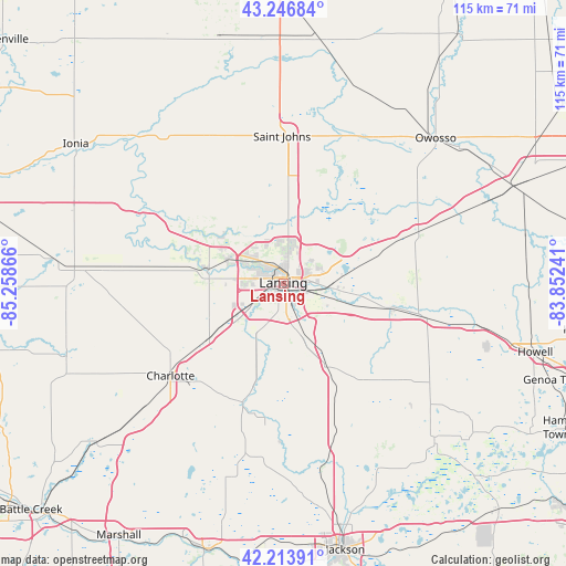
Lansing GPS coordinates[2]
42° 43' 57.108" North, 84° 33' 19.908" West
| Map corner | latitude | longitude |
|---|---|---|
| Upper-left | 43.24684°, | -85.25866° |
| Center: | 42.73253°, | -84.55553° |
| Lower-right: | 42.21391°, | -83.85241° |
| Map W x H: | 114.9×114.8 km | = 71.4×71.3mi |
| max Lat: | 71.29058° ⇑18.5% North |
| Lansing: | 42.73253° |
| min Lat: | ⇓81.5% South 19.06759° |
| min Long | Lansing | max Long |
| -171.73463° | -84.55553° | -66.98998° |
| W 57.2%⇐ | ⇒42.8% E |
Elevation
Elevation of Lansing is 260 m = 853 ft, and this is 34.8 m = 114 ft below average elevation for this country.
| Max E: |
3189 m = 10463 ft | 35.5% |
| Avg. | 294.8 m = 967 ft | |
| Lansing | 260 m = 853 ft | |
Min E: |
-60 m = -197 ft | 64.5% |
See also: Lansing elevation on elevation.city.
Geographical zone
Lansing is located in North temperate zone (between Tropic of Cancer and the Arctic Circle). Distance of this Northern Tropic circle is 2145.5 km =1333.2 mi to South.| Distance of | km | miles | from Lansing |
|---|---|---|---|
| North Pole | 5255.6 | 3265.7 | to North |
| Arctic Circle | 2649.8 | 1646.5 | to North |
| Tropic Cancer | 2145.5 | 1333.2 | to South |
| Equator | 4751.4 | 2952.4 | to South |


Nearby cities:
15 places around Lansing: (largest is in red/bold)
• Bath
13 km =8.1 mi,  42°
42°
• DeWitt
12.3 km =7.6 mi,  354°
354°
• Dimondale
12.3 km =7.6 mi,  218°
218°
• East Lansing
5.9 km =3.7 mi,  85°
85°
• Edgemont Park
3.5 km =2.2 mi,  296°
296°
• Grand Ledge
15.8 km =9.8 mi,  278°
278°
• Haslett
12.7 km =7.9 mi,  82°
82°
• Holt
10.7 km =6.6 mi,  162°
162°
• Laingsburg
24.2 km =15 mi, 43°
• Mason
19.4 km =12.1 mi,  151°
151°
• Okemos
10.5 km =6.5 mi,  96°
96°
• Potterville
18.9 km =11.7 mi,  232°
232°
• Wacousta
15.9 km =9.9 mi,  311°
311°
• Waverly
5.4 km =3.4 mi, 277°
• Williamston
22.8 km =14.2 mi, 102°
Sources, notices
• [Note1] Compared only with cities in United States existing in our database
• [Src1] Map data: © OpenStreetMap contributors (CC-BY-SA)
• [Src2] Other city data from geonames.org with taken over terms of usage.
• [Src3] Geographical zone / Annual Mean Temperature by Robert A. Rohde @ Wikipedia
