Wacousta geodata
Wacousta (Michigan) is a populated place; located in United States in America/Detroit (GMT-4) time zone. With population of 1,440 people, there are 13919 cities with bigger population in this country. Compared to other cities in United States, 82% of cities are located further ↓South; 56.6% of cities are located further ←West and 60.7% of cities have lower elevation than Wacousta. Note1
Administrative division(s):
- Level 1: Michigan
- Level 2: Clinton County
- Level 3: Charter Township of Watertown


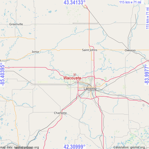
Wacousta GPS coordinates[2]
42° 49' 40.116" North, 84° 42' 2.952" West
| Map corner | latitude | longitude |
|---|---|---|
| Upper-left | 43.34133°, | -85.40395° |
| Center: | 42.82781°, | -84.70082° |
| Lower-right: | 42.30999°, | -83.9977° |
| Map W x H: | 114.7×114.7 km | = 71.3×71.3mi |
| max Lat: | 71.29058° ⇑18% North |
| Wacousta: | 42.82781° |
| min Lat: | ⇓82% South 19.06759° |
| min Long | Wacousta | max Long |
| -171.73463° | -84.70082° | -66.98998° |
| W 56.6%⇐ | ⇒43.4% E |
Elevation
Elevation of Wacousta is 243 m = 797 ft, and this is 51.8 m = 170 ft below average elevation for this country.
| Max E: |
3189 m = 10463 ft | 39.3% |
| Avg. | 294.8 m = 967 ft | |
| Wacousta | 243 m = 797 ft | |
Min E: |
-60 m = -197 ft | 60.7% |
See also: United States elevation on elevation.city.
Geographical zone
Wacousta is located in North temperate zone (between Tropic of Cancer and the Arctic Circle). Distance of this Northern Tropic circle is 2156.1 km =1339.7 mi to South.| Distance of | km | miles | from Wacousta |
|---|---|---|---|
| North Pole | 5245.1 | 3259.2 | to North |
| Arctic Circle | 2639.2 | 1639.9 | to North |
| Tropic Cancer | 2156.1 | 1339.7 | to South |
| Equator | 4762 | 2959 | to South |


Nearby cities:
15 places around Wacousta: (largest is in red/bold)
• Bath
20.6 km =12.8 mi,  92°
92°
• DeWitt
10.9 km =6.8 mi,  81°
81°
• Dimondale
20.7 km =12.9 mi,  168°
168°
• East Lansing
20.4 km =12.7 mi,  119°
119°
• Edgemont Park
12.6 km =7.8 mi,  135°
135°
• Fowler
19.6 km =12.2 mi,  350°
350°
• Grand Ledge
9.1 km =5.7 mi,  204°
204°
• Lansing
15.9 km =9.9 mi,  131°
131°
• Mulliken
17.5 km =10.9 mi,  245°
245°
• Portland
17.1 km =10.6 mi,  285°
285°
• Potterville
22.3 km =13.9 mi,  188°
188°
• Saint Johns
22.5 km =14 mi,  30°
30°
• Sunfield
24.9 km =15.5 mi, 252°
• Waverly
11.8 km =7.3 mi,  146°
146°
• Westphalia
13.8 km =8.6 mi,  324°
324°
Sources, notices
• [Note1] Compared only with cities in United States existing in our database
• [Src1] Map data: © OpenStreetMap contributors (CC-BY-SA)
• [Src2] Other city data from geonames.org with taken over terms of usage.
• [Src3] Geographical zone / Annual Mean Temperature by Robert A. Rohde @ Wikipedia
