Northport geodata
Northport (Michigan) is a populated place; located in United States in America/Detroit (GMT-4) time zone. With population of 531 people, there are 20491 cities with bigger population in this country. Compared to other cities in United States, 93% of cities are located further ↓South; 54.2% of cities are located further ←West and 53.1% of cities have higher elevation than Northport. Note1
Administrative division(s):
- Level 1: Michigan
- Level 2: Leelanau County
- Level 3: Township of Leelanau


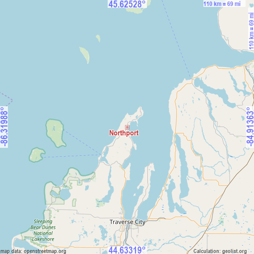
Northport GPS coordinates[2]
45° 7' 53.004" North, 85° 37' 0.3" West
| Map corner | latitude | longitude |
|---|---|---|
| Upper-left | 45.62528°, | -86.31988° |
| Center: | 45.13139°, | -85.61675° |
| Lower-right: | 44.63319°, | -84.91363° |
| Map W x H: | 110.3×110.3 km | = 68.5×68.5mi |
| max Lat: | 71.29058° ⇑7% North |
| Northport: | 45.13139° |
| min Lat: | ⇓93% South 19.06759° |
| min Long | Northport | max Long |
| -171.73463° | -85.61675° | -66.98998° |
| W 54.2%⇐ | ⇒45.8% E |
Elevation
Elevation of Northport is 187 m = 614 ft, and this is 107.8 m = 354 ft below average elevation for this country.
| Max E: |
3189 m = 10463 ft | 53.1% |
| Avg. | 294.8 m = 967 ft | |
| Northport | 187 m = 614 ft | |
Min E: |
-60 m = -197 ft | 46.9% |
See also: United States elevation on elevation.city.
Geographical zone
Northport is located in North temperate zone (between Tropic of Cancer and the Arctic Circle). Distance of this North polar circle is 2383 km =1480.7 mi to North.| Distance of | km | miles | from Northport |
|---|---|---|---|
| North Pole | 4988.9 | 3100 | to North |
| Arctic Circle | 2383 | 1480.7 | to North |
| Tropic Cancer | 2412.2 | 1498.9 | to South |
| Equator | 5018.1 | 3118.1 | to South |


Nearby cities:
15 places around Northport: (largest is in red/bold)
• Bay Harbor
49.2 km =30.6 mi,  58°
58°
• Bay Shore
47.9 km =29.8 mi, 58°
• Bellaire
36 km =22.4 mi,  117°
117°
• Boyne City
48.2 km =30 mi,  78°
78°
• Central Lake
28.5 km =17.7 mi,  103°
103°
• Charlevoix
34.9 km =21.7 mi,  53°
53°
• East Jordan
38.7 km =24 mi,  85°
85°
• Elk Rapids
30.6 km =19 mi,  149°
149°
• Greilickville
38.8 km =24.1 mi,  182°
182°
• Horton Bay
45.4 km =28.2 mi,  68°
68°
• Leland
16.5 km =10.3 mi,  222°
222°
• Mancelona
50.6 km =31.4 mi, 120°
• Rapid City
42.2 km =26.2 mi,  141°
141°
• Suttons Bay
17.4 km =10.8 mi,  188°
188°
• Traverse City
41 km =25.5 mi, 180°
Sources, notices
• [Note1] Compared only with cities in United States existing in our database
• [Src1] Map data: © OpenStreetMap contributors (CC-BY-SA)
• [Src2] Other city data from geonames.org with taken over terms of usage.
• [Src3] Geographical zone / Annual Mean Temperature by Robert A. Rohde @ Wikipedia
