Richland geodata
Richland (Michigan) is a populated place; located in United States in America/Detroit (GMT-4) time zone. With population of 786 people, there are 17935 cities with bigger population in this country. Compared to other cities in United States, 78.8% of cities are located further ↓South; 54.7% of cities are located further ←West and 70.1% of cities have lower elevation than Richland. Note1
Administrative division(s):
- Level 1: Michigan
- Level 2: Kalamazoo County
- Level 3: Township of Richland


Richland GPS coordinates[2]
42° 22' 34.14" North, 85° 27' 18.036" West
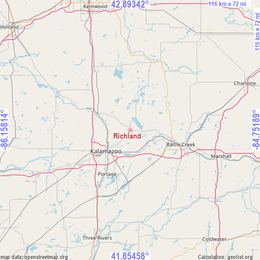
| Map corner | latitude | longitude |
|---|---|---|
| Upper-left | 42.89342°, | -86.15814° |
| Center: | 42.37615°, | -85.45501° |
| Lower-right: | 41.85458°, | -84.75189° |
| Map W x H: | 115.5×115.5 km | = 71.8×71.8mi |
| max Lat: | 71.29058° ⇑21.2% North |
| Richland: | 42.37615° |
| min Lat: | ⇓78.8% South 19.06759° |
| min Long | Richland | max Long |
| -171.73463° | -85.45501° | -66.98998° |
| W 54.7%⇐ | ⇒45.3% E |
Elevation
Elevation of Richland is 286 m = 938 ft, and this is 8.8 m = 29 ft below average elevation for this country.
| Max E: |
3189 m = 10463 ft | 29.9% |
| Avg. | 294.8 m = 967 ft | |
| Richland | 286 m = 938 ft | |
Min E: |
-60 m = -197 ft | 70.1% |
See also: United States elevation on elevation.city.
Geographical zone
Richland is located in North temperate zone (between Tropic of Cancer and the Arctic Circle). Distance of this Northern Tropic circle is 2105.9 km =1308.5 mi to South.| Distance of | km | miles | from Richland |
|---|---|---|---|
| North Pole | 5295.3 | 3290.3 | to North |
| Arctic Circle | 2689.4 | 1671.1 | to North |
| Tropic Cancer | 2105.9 | 1308.5 | to South |
| Equator | 4711.8 | 2927.8 | to South |


Nearby cities:
15 places around Richland: (largest is in red/bold)
• Augusta
9.5 km =5.9 mi,  117°
117°
• Climax
18.2 km =11.3 mi,  147°
147°
• Comstock Northwest
7.9 km =4.9 mi,  220°
220°
• Delton
14.3 km =8.9 mi,  15°
15°
• Eastwood
11.3 km =7 mi, 223°
• Galesburg
10.2 km =6.3 mi,  162°
162°
• Kalamazoo
14.4 km =8.9 mi,  229°
229°
• Lakeview
21.8 km =13.5 mi,  113°
113°
• Level Park-Oak Park
15.5 km =9.6 mi,  94°
94°
• Parchment
10.8 km =6.7 mi,  240°
240°
• Plainwell
17.4 km =10.8 mi,  294°
294°
• South Gull Lake
5 km =3.1 mi,  75°
75°
• Springfield
18.6 km =11.6 mi, 107°
• Stony Point
13.6 km =8.5 mi,  9°
9°
• Westwood
16.8 km =10.4 mi, 240°
Sources, notices
• [Note1] Compared only with cities in United States existing in our database
• [Src1] Map data: © OpenStreetMap contributors (CC-BY-SA)
• [Src2] Other city data from geonames.org with taken over terms of usage.
• [Src3] Geographical zone / Annual Mean Temperature by Robert A. Rohde @ Wikipedia
