Kalamazoo geodata
Kalamazoo (Michigan) is a seat of a second-order administrative division; located in United States in America/Detroit (GMT-4) time zone. With population of 76,041 people, there are 530 cities with bigger population in this country. Compared to other cities in United States, 78.1% of cities are located further ↓South; 54.3% of cities are located further ←West and 60.5% of cities have lower elevation than Kalamazoo. Note1


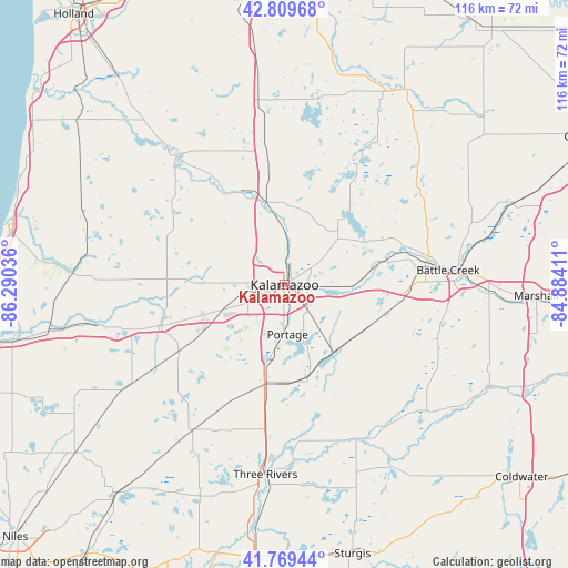
Kalamazoo GPS coordinates[2]
42° 17' 30.156" North, 85° 35' 14.028" West
| Map corner | latitude | longitude |
|---|---|---|
| Upper-left | 42.80968°, | -86.29036° |
| Center: | 42.29171°, | -85.58723° |
| Lower-right: | 41.76944°, | -84.88411° |
| Map W x H: | 115.7×115.7 km | = 71.9×71.9mi |
| max Lat: | 71.29058° ⇑21.9% North |
| Kalamazoo: | 42.29171° |
| min Lat: | ⇓78.1% South 19.06759° |
| min Long | Kalamazoo | max Long |
| -171.73463° | -85.58723° | -66.98998° |
| W 54.3%⇐ | ⇒45.7% E |
Elevation
Elevation of Kalamazoo is 242 m = 794 ft, and this is 52.8 m = 173 ft below average elevation for this country.
| Max E: |
3189 m = 10463 ft | 39.5% |
| Avg. | 294.8 m = 967 ft | |
| Kalamazoo | 242 m = 794 ft | |
Min E: |
-60 m = -197 ft | 60.5% |
See also: Kalamazoo elevation on elevation.city.
Geographical zone
Kalamazoo is located in North temperate zone (between Tropic of Cancer and the Arctic Circle). Distance of this Northern Tropic circle is 2096.5 km =1302.7 mi to South.| Distance of | km | miles | from Kalamazoo |
|---|---|---|---|
| North Pole | 5304.7 | 3296.2 | to North |
| Arctic Circle | 2698.8 | 1677 | to North |
| Tropic Cancer | 2096.5 | 1302.7 | to South |
| Equator | 4702.4 | 2921.9 | to South |


Nearby cities:
15 places around Kalamazoo: (largest is in red/bold)
• Augusta
20 km =12.4 mi,  75°
75°
• Climax
21.6 km =13.4 mi,  105°
105°
• Comstock Northwest
6.6 km =4.1 mi,  59°
59°
• Eastwood
3.3 km =2.1 mi,  67°
67°
• Galesburg
13.9 km =8.6 mi,  91°
91°
• Mattawan
18.6 km =11.6 mi,  240°
240°
• Otsego
20.8 km =12.9 mi,  334°
334°
• Parchment
4.3 km =2.7 mi,  19°
19°
• Plainwell
17.3 km =10.7 mi,  342°
342°
• Portage
10.1 km =6.3 mi,  176°
176°
• Richland
14.4 km =8.9 mi,  49°
49°
• Schoolcraft
20.2 km =12.6 mi,  191°
191°
• South Gull Lake
18.9 km =11.7 mi, 55°
• Vicksburg
19.6 km =12.2 mi,  166°
166°
• Westwood
4 km =2.5 mi,  287°
287°
Sources, notices
• [Note1] Compared only with cities in United States existing in our database
• [Src1] Map data: © OpenStreetMap contributors (CC-BY-SA)
• [Src2] Other city data from geonames.org with taken over terms of usage.
• [Src3] Geographical zone / Annual Mean Temperature by Robert A. Rohde @ Wikipedia
