Le Center geodata
Le Center (Minnesota) is a seat of a second-order administrative division; located in United States in America/Chicago (GMT-5) time zone. With population of 2,459 people, there are 10723 cities with bigger population in this country. Compared to other cities in United States, 90% of cities are located further ↓South; 68.1% of cities are located further →East and 76.3% of cities have lower elevation than Le Center. Note1


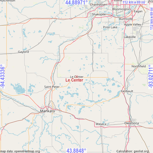
Le Center GPS coordinates[2]
44° 23' 21.876" North, 93° 43' 48.828" West
| Map corner | latitude | longitude |
|---|---|---|
| Upper-left | 44.88971°, | -94.43336° |
| Center: | 44.38941°, | -93.73023° |
| Lower-right: | 43.8848°, | -93.02711° |
| Map W x H: | 111.7×111.7 km | = 69.4×69.4mi |
| max Lat: | 71.29058° ⇑10% North |
| Le Center: | 44.38941° |
| min Lat: | ⇓90% South 19.06759° |
| min Long | Le Center | max Long |
| -171.73463° | -93.73023° | -66.98998° |
| W 31.9%⇐ | ⇒68.1% E |
Elevation
Elevation of Le Center is 322 m = 1056 ft, and this is 27.2 m = 89 ft above average elevation for this country.
| Max E: |
3189 m = 10463 ft | 23.7% |
| Le Center | 322 m 1056 ft | |
| Avg. | 294.8 m = 967 ft | |
Min E: |
-60 m = -197 ft | 76.3% |
See also: United States elevation on elevation.city.
Geographical zone
Le Center is located in North temperate zone (between Tropic of Cancer and the Arctic Circle). Distance of this Northern Tropic circle is 2329.7 km =1447.6 mi to South.| Distance of | km | miles | from Le Center |
|---|---|---|---|
| North Pole | 5071.4 | 3151.2 | to North |
| Arctic Circle | 2465.5 | 1532 | to North |
| Tropic Cancer | 2329.7 | 1447.6 | to South |
| Equator | 4935.6 | 3066.8 | to South |


Nearby cities:
15 places around Le Center: (largest is in red/bold)
• Belle Plaine
26.1 km =16.2 mi,  353°
353°
• Cleveland
11.1 km =6.9 mi,  230°
230°
• Eagle Lake
27.7 km =17.2 mi,  205°
205°
• Elysian
21.7 km =13.5 mi,  168°
168°
• Henderson
20.9 km =13 mi,  317°
317°
• Janesville
30.4 km =18.9 mi,  176°
176°
• Kasota
21.6 km =13.4 mi,  239°
239°
• Le Sueur
16.7 km =10.4 mi,  298°
298°
• Lonsdale
26 km =16.2 mi,  67°
67°
• Madison Lake
21.7 km =13.5 mi,  198°
198°
• Montgomery
13 km =8.1 mi, 65°
• Morristown
29 km =18 mi,  128°
128°
• New Prague
21 km =13 mi,  35°
35°
• Saint Peter
19.5 km =12.1 mi,  247°
247°
• Waterville
22.9 km =14.2 mi,  145°
145°
Sources, notices
• [Note1] Compared only with cities in United States existing in our database
• [Src1] Map data: © OpenStreetMap contributors (CC-BY-SA)
• [Src2] Other city data from geonames.org with taken over terms of usage.
• [Src3] Geographical zone / Annual Mean Temperature by Robert A. Rohde @ Wikipedia
