Saint Peter geodata
Saint Peter (Minnesota) is a seat of a second-order administrative division; located in United States in America/Chicago (GMT-5) time zone. With population of 11,196 people, there are 4125 cities with bigger population in this country. Compared to other cities in United States, 89.8% of cities are located further ↓South; 68.5% of cities are located further →East and 58.6% of cities have lower elevation than Saint Peter. Note1
Administrative division(s):
- Level 1: Minnesota
- Level 2: Nicollet County
- Level 3: City of Saint Peter


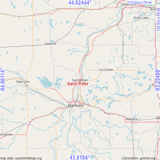
Saint Peter GPS coordinates[2]
44° 19' 24.888" North, 93° 57' 28.836" West
| Map corner | latitude | longitude |
|---|---|---|
| Upper-left | 44.82444°, | -94.66114° |
| Center: | 44.32358°, | -93.95801° |
| Lower-right: | 43.8184°, | -93.25489° |
| Map W x H: | 111.9×111.9 km | = 69.5×69.5mi |
| max Lat: | 71.29058° ⇑10.2% North |
| Saint Peter: | 44.32358° |
| min Lat: | ⇓89.8% South 19.06759° |
| min Long | Saint Peter | max Long |
| -171.73463° | -93.95801° | -66.98998° |
| W 31.5%⇐ | ⇒68.5% E |
Elevation
Elevation of Saint Peter is 233 m = 764 ft, and this is 61.8 m = 203 ft below average elevation for this country.
| Max E: |
3189 m = 10463 ft | 41.4% |
| Avg. | 294.8 m = 967 ft | |
| Saint Peter | 233 m = 764 ft | |
Min E: |
-60 m = -197 ft | 58.6% |
See also: United States elevation on elevation.city.
Geographical zone
Saint Peter is located in North temperate zone (between Tropic of Cancer and the Arctic Circle). Distance of this Northern Tropic circle is 2322.4 km =1443.1 mi to South.| Distance of | km | miles | from Saint Peter |
|---|---|---|---|
| North Pole | 5078.7 | 3155.8 | to North |
| Arctic Circle | 2472.9 | 1536.6 | to North |
| Tropic Cancer | 2322.4 | 1443.1 | to South |
| Equator | 4928.3 | 3062.3 | to South |


Nearby cities:
15 places around Saint Peter: (largest is in red/bold)
• Cleveland
9.6 km =6 mi,  88°
88°
• Courtland
31 km =19.3 mi,  258°
258°
• Eagle Lake
18.7 km =11.6 mi,  160°
160°
• Elysian
26.6 km =16.5 mi,  121°
121°
• Henderson
23.1 km =14.4 mi,  9°
9°
• Janesville
30.5 km =19 mi,  139°
139°
• Kasota
3.5 km =2.2 mi,  189°
189°
• Lake Crystal
31.9 km =19.8 mi,  220°
220°
• Le Center
19.5 km =12.1 mi,  67°
67°
• Le Sueur
15.7 km =9.8 mi, 12°
• Madison Lake
17.4 km =10.8 mi, 139°
• Mankato
18.7 km =11.6 mi, 192°
• Nicollet
19 km =11.8 mi,  253°
253°
• North Mankato
17.8 km =11.1 mi,  199°
199°
• Saint Clair
28 km =17.4 mi, 163°
Sources, notices
• [Note1] Compared only with cities in United States existing in our database
• [Src1] Map data: © OpenStreetMap contributors (CC-BY-SA)
• [Src2] Other city data from geonames.org with taken over terms of usage.
• [Src3] Geographical zone / Annual Mean Temperature by Robert A. Rohde @ Wikipedia
