Mabel geodata
Mabel (Minnesota) is a populated place; located in United States in America/Chicago (GMT-5) time zone. With population of 760 people, there are 18129 cities with bigger population in this country. Compared to other cities in United States, 86.4% of cities are located further ↓South; 63.6% of cities are located further →East and 79.3% of cities have lower elevation than Mabel. Note1


Mabel GPS coordinates[2]
43° 31' 13.872" North, 91° 46' 10.524" West
| Map corner | latitude | longitude |
|---|---|---|
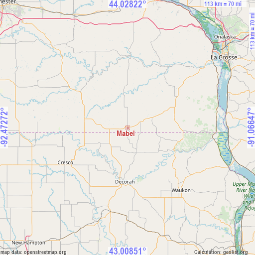
| Upper-left | 44.02822°, | -92.47272° |
| Center: | 43.52052°, | -91.76959° |
| Lower-right: | 43.00851°, | -91.06647° |
| Map W x H: | 113.4×113.4 km | = 70.5×70.5mi |
| max Lat: | 71.29058° ⇑13.6% North |
| Mabel: | 43.52052° |
| min Lat: | ⇓86.4% South 19.06759° |
| min Long | Mabel | max Long |
| -171.73463° | -91.76959° | -66.98998° |
| W 36.4%⇐ | ⇒63.6% E |
Elevation
Elevation of Mabel is 347 m = 1138 ft, and this is 52.2 m = 171 ft above average elevation for this country.
| Max E: |
3189 m = 10463 ft | 20.7% |
| Mabel | 347 m 1138 ft | |
| Avg. | 294.8 m = 967 ft | |
Min E: |
-60 m = -197 ft | 79.3% |
See also: United States elevation on elevation.city.
Geographical zone
Mabel is located in North temperate zone (between Tropic of Cancer and the Arctic Circle). Distance of this Northern Tropic circle is 2233.1 km =1387.6 mi to South.| Distance of | km | miles | from Mabel |
|---|---|---|---|
| North Pole | 5168 | 3211.2 | to North |
| Arctic Circle | 2562.1 | 1592 | to North |
| Tropic Cancer | 2233.1 | 1387.6 | to South |
| Equator | 4839 | 3006.8 | to South |


Nearby cities:
15 places around Mabel: (largest is in red/bold)
• Caledonia
25.4 km =15.8 mi,  59°
59°
• Calmar
38.2 km =23.7 mi,  191°
191°
• Cresco
31.8 km =19.8 mi,  240°
240°
• Decorah
24.2 km =15 mi,  183°
183°
• Harmony
19.8 km =12.3 mi,  281°
281°
• Hokah
43.2 km =26.8 mi,  52°
52°
• Houston
31.5 km =19.6 mi,  30°
30°
• Lanesboro
27.8 km =17.3 mi,  323°
323°
• Ossian
41.6 km =25.8 mi, 179°
• Preston
30.2 km =18.8 mi,  303°
303°
• Rushford
32 km =19.9 mi,  2°
2°
• Rushford Village
31.9 km =19.8 mi,  356°
356°
• Spring Grove
11.7 km =7.3 mi,  67°
67°
• Stoddard
47.1 km =29.3 mi, 70°
• Waukon
36.7 km =22.8 mi,  139°
139°
Sources, notices
• [Note1] Compared only with cities in United States existing in our database
• [Src1] Map data: © OpenStreetMap contributors (CC-BY-SA)
• [Src2] Other city data from geonames.org with taken over terms of usage.
• [Src3] Geographical zone / Annual Mean Temperature by Robert A. Rohde @ Wikipedia
