Rushford Village geodata
Rushford Village (Minnesota) is a populated place; located in United States in America/Chicago (GMT-5) time zone. With population of 808 people, there are 17736 cities with bigger population in this country. Compared to other cities in United States, 87.6% of cities are located further ↓South; 63.7% of cities are located further →East and 56.7% of cities have lower elevation than Rushford Village. Note1
Administrative division(s):
- Level 1: Minnesota
- Level 2: Fillmore County
- Level 3: City of Rushford Village


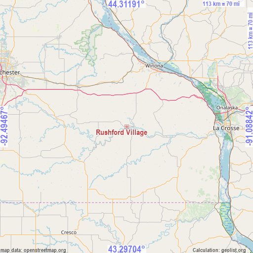
Rushford Village GPS coordinates[2]
43° 48' 23.868" North, 91° 47' 29.544" West
| Map corner | latitude | longitude |
|---|---|---|
| Upper-left | 44.31191°, | -92.49467° |
| Center: | 43.80663°, | -91.79154° |
| Lower-right: | 43.29704°, | -91.08842° |
| Map W x H: | 112.8×112.8 km | = 70.1×70.1mi |
| max Lat: | 71.29058° ⇑12.4% North |
| Rushford Village: | 43.80663° |
| min Lat: | ⇓87.6% South 19.06759° |
| min Long | Rushford Villag | max Long |
| -171.73463° | -91.79154° | -66.98998° |
| W 36.3%⇐ | ⇒63.7% E |
Elevation
Elevation of Rushford Village is 225 m = 738 ft, and this is 69.8 m = 229 ft below average elevation for this country.
| Max E: |
3189 m = 10463 ft | 43.3% |
| Avg. | 294.8 m = 967 ft | |
| Rushford Village | 225 m = 738 ft | |
Min E: |
-60 m = -197 ft | 56.7% |
See also: United States elevation on elevation.city.
Geographical zone
Rushford Village is located in North temperate zone (between Tropic of Cancer and the Arctic Circle). Distance of this Northern Tropic circle is 2264.9 km =1407.3 mi to South.| Distance of | km | miles | from Rushford Village |
|---|---|---|---|
| North Pole | 5136.2 | 3191.5 | to North |
| Arctic Circle | 2530.3 | 1572.3 | to North |
| Tropic Cancer | 2264.9 | 1407.3 | to South |
| Equator | 4870.8 | 3026.6 | to South |


Nearby cities:
15 places around Rushford Village: (largest is in red/bold)
• Caledonia
30.4 km =18.9 mi,  128°
128°
• Chatfield
32.2 km =20 mi,  277°
277°
• Goodview
29.5 km =18.3 mi,  15°
15°
• Harmony
33 km =20.5 mi,  212°
212°
• Houston
18.5 km =11.5 mi,  105°
105°
• Lanesboro
17.7 km =11 mi,  237°
237°
• Lewiston
20.7 km =12.9 mi,  342°
342°
• Mabel
31.9 km =19.8 mi,  176°
176°
• Preston
27.9 km =17.3 mi, 237°
• Rollingstone
32.4 km =20.1 mi,  356°
356°
• Rushford
3.1 km =1.9 mi,  86°
86°
• Saint Charles
28.4 km =17.6 mi,  309°
309°
• Spring Grove
30 km =18.6 mi,  155°
155°
• Stockton
24.6 km =15.3 mi,  4°
4°
• Winona
29.7 km =18.5 mi, 24°
Sources, notices
• [Note1] Compared only with cities in United States existing in our database
• [Src1] Map data: © OpenStreetMap contributors (CC-BY-SA)
• [Src2] Other city data from geonames.org with taken over terms of usage.
• [Src3] Geographical zone / Annual Mean Temperature by Robert A. Rohde @ Wikipedia
