Minnesota Lake geodata
Minnesota Lake (Minnesota) is a populated place; located in United States in America/Chicago (GMT-5) time zone. With population of 662 people, there are 19049 cities with bigger population in this country. Compared to other cities in United States, 87.8% of cities are located further ↓South; 68.3% of cities are located further →East and 76% of cities have lower elevation than Minnesota Lake. Note1
Administrative division(s):
- Level 1: Minnesota
- Level 2: Faribault County
- Level 3: City of Minnesota Lake


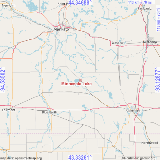
Minnesota Lake GPS coordinates[2]
43° 50' 30.84" North, 93° 49' 54.804" West
| Map corner | latitude | longitude |
|---|---|---|
| Upper-left | 44.34688°, | -94.53502° |
| Center: | 43.8419°, | -93.83189° |
| Lower-right: | 43.33261°, | -93.12877° |
| Map W x H: | 112.8×112.8 km | = 70.1×70.1mi |
| max Lat: | 71.29058° ⇑12.2% North |
| Minnesota Lake: | 43.8419° |
| min Lat: | ⇓87.8% South 19.06759° |
| min Long | Minnesota Lake | max Long |
| -171.73463° | -93.83189° | -66.98998° |
| W 31.7%⇐ | ⇒68.3% E |
Elevation
Elevation of Minnesota Lake is 320 m = 1050 ft, and this is 25.2 m = 83 ft above average elevation for this country.
| Max E: |
3189 m = 10463 ft | 24% |
| Minnesota Lake | 320 m 1050 ft | |
| Avg. | 294.8 m = 967 ft | |
Min E: |
-60 m = -197 ft | 76% |
See also: United States elevation on elevation.city.
Geographical zone
Minnesota Lake is located in North temperate zone (between Tropic of Cancer and the Arctic Circle). Distance of this Northern Tropic circle is 2268.8 km =1409.8 mi to South.| Distance of | km | miles | from Minnesota Lake |
|---|---|---|---|
| North Pole | 5132.3 | 3189.1 | to North |
| Arctic Circle | 2526.4 | 1569.8 | to North |
| Tropic Cancer | 2268.8 | 1409.8 | to South |
| Equator | 4874.8 | 3029.1 | to South |


Nearby cities:
15 places around Minnesota Lake: (largest is in red/bold)
• Alden
28 km =17.4 mi,  132°
132°
• Amboy
26.5 km =16.5 mi,  281°
281°
• Blue Earth
31.4 km =19.5 mi,  223°
223°
• Eagle Lake
36.1 km =22.4 mi,  353°
353°
• Good Thunder
26 km =16.2 mi,  314°
314°
• Janesville
32.1 km =19.9 mi,  18°
18°
• Madison Lake
40.3 km =25 mi,  1°
1°
• Mankato
38 km =23.6 mi,  338°
338°
• Mapleton
13.9 km =8.6 mi, 314°
• New Richland
27.7 km =17.2 mi,  77°
77°
• North Mankato
40.2 km =25 mi, 336°
• Saint Clair
26.8 km =16.7 mi,  355°
355°
• Waseca
36.9 km =22.9 mi,  44°
44°
• Wells
13.5 km =8.4 mi,  142°
142°
• Winnebago
28 km =17.4 mi,  252°
252°
Sources, notices
• [Note1] Compared only with cities in United States existing in our database
• [Src1] Map data: © OpenStreetMap contributors (CC-BY-SA)
• [Src2] Other city data from geonames.org with taken over terms of usage.
• [Src3] Geographical zone / Annual Mean Temperature by Robert A. Rohde @ Wikipedia
