Norwood (historical) geodata
Norwood (historical) (Minnesota) is a abandoned populated place; located in United States in America/Chicago (GMT-5) time zone. With population of 1,506 people, there are 13631 cities with bigger population in this country. Compared to other cities in United States, 91.5% of cities are located further ↓South; 68.5% of cities are located further →East and 72.9% of cities have lower elevation than Norwood (historical). Note1
Administrative division(s):
- Level 1: Minnesota
- Level 2: Carver County
- Level 3: City of Norwood Young America


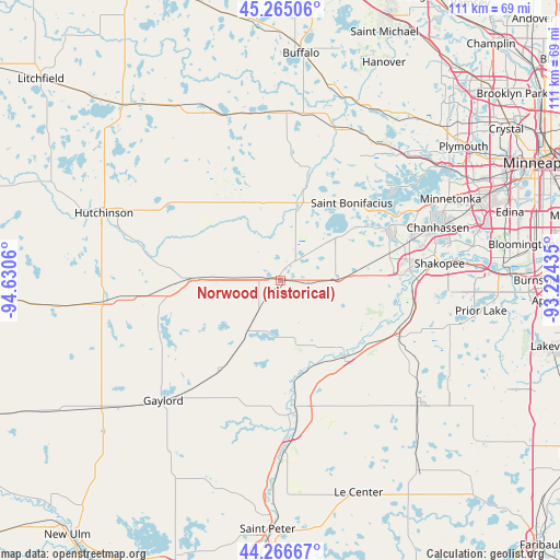
Norwood (historical) GPS coordinates[2]
44° 46' 4.872" North, 93° 55' 38.892" West
| Map corner | latitude | longitude |
|---|---|---|
| Upper-left | 45.26506°, | -94.6306° |
| Center: | 44.76802°, | -93.92747° |
| Lower-right: | 44.26667°, | -93.22435° |
| Map W x H: | 111×111 km | = 69×69mi |
| max Lat: | 71.29058° ⇑8.5% North |
| Norwood (historical): | 44.76802° |
| min Lat: | ⇓91.5% South 19.06759° |
| min Long | Norwood (histor | max Long |
| -171.73463° | -93.92747° | -66.98998° |
| W 31.5%⇐ | ⇒68.5% E |
Elevation
Elevation of Norwood (historical) is 301 m = 988 ft, and this is 6.2 m = 20 ft above average elevation for this country.
| Max E: |
3189 m = 10463 ft | 27.1% |
| Norwood (historical) | 301 m 988 ft | |
| Avg. | 294.8 m = 967 ft | |
Min E: |
-60 m = -197 ft | 72.9% |
See also: United States elevation on elevation.city.
Geographical zone
Norwood (historical) is located in North temperate zone (between Tropic of Cancer and the Arctic Circle). Distance of this Northern Tropic circle is 2371.8 km =1473.8 mi to South.| Distance of | km | miles | from Norwood (historical) |
|---|---|---|---|
| North Pole | 5029.3 | 3125.1 | to North |
| Arctic Circle | 2423.4 | 1505.8 | to North |
| Tropic Cancer | 2371.8 | 1473.8 | to South |
| Equator | 4977.7 | 3093 | to South |


Nearby cities:
15 places around Norwood (historical): (largest is in red/bold)
• Arlington
21.5 km =13.4 mi,  214°
214°
• Belle Plaine
20.5 km =12.7 mi,  142°
142°
• Cologne
11.5 km =7.1 mi,  88°
88°
• Glencoe
17.7 km =11 mi,  270°
270°
• Green Isle
11.8 km =7.3 mi, 212°
• Hamburg
5 km =3.1 mi,  219°
219°
• Lester Prairie
15.7 km =9.8 mi,  325°
325°
• Mayer
13.4 km =8.3 mi,  13°
13°
• Norwood Young America
0.8 km =0.5 mi,  36°
36°
• Saint Bonifacius
20.9 km =13 mi, 42°
• Victoria
23.3 km =14.5 mi,  64°
64°
• Waconia
14.4 km =8.9 mi,  50°
50°
• Watertown
22.6 km =14 mi,  16°
16°
• Winsted
23.7 km =14.7 mi,  336°
336°
• Young America (historical)
2 km =1.2 mi,  33°
33°
Sources, notices
• [Note1] Compared only with cities in United States existing in our database
• [Src1] Map data: © OpenStreetMap contributors (CC-BY-SA)
• [Src2] Other city data from geonames.org with taken over terms of usage.
• [Src3] Geographical zone / Annual Mean Temperature by Robert A. Rohde @ Wikipedia
