Kearny geodata
Kearny (New Jersey) is a populated place; located in United States in America/New_York (GMT-4) time zone. With population of 42,137 people, there are 1136 cities with bigger population in this country. Compared to other cities in United States, 62.6% of cities are located further ↓South; 89.7% of cities are located further ←West and 82.9% of cities have higher elevation than Kearny. Note1


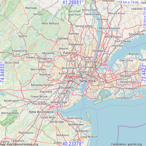
Kearny GPS coordinates[2]
40° 46' 6.348" North, 74° 8' 43.512" West
| Map corner | latitude | longitude |
|---|---|---|
| Upper-left | 41.29881°, | -74.84855° |
| Center: | 40.76843°, | -74.14542° |
| Lower-right: | 40.23378°, | -73.4423° |
| Map W x H: | 118.4×118.4 km | = 73.6×73.6mi |
| max Lat: | 71.29058° ⇑37.4% North |
| Kearny: | 40.76843° |
| min Lat: | ⇓62.6% South 19.06759° |
| min Long | Kearny | max Long |
| -171.73463° | -74.14542° | -66.98998° |
| W 89.7%⇐ | ⇒10.3% E |
Elevation
Elevation of Kearny is 35 m = 115 ft, and this is 259.8 m = 852 ft below average elevation for this country.
| Max E: |
3189 m = 10463 ft | 82.9% |
| Avg. | 294.8 m = 967 ft | |
| Kearny | 35 m = 115 ft | |
Min E: |
-60 m = -197 ft | 17.1% |
See also: Kearny elevation on elevation.city.
Geographical zone
Kearny is located in North temperate zone (between Tropic of Cancer and the Arctic Circle). Distance of this Northern Tropic circle is 1927.1 km =1197.4 mi to South.| Distance of | km | miles | from Kearny |
|---|---|---|---|
| North Pole | 5474 | 3401.4 | to North |
| Arctic Circle | 2868.1 | 1782.2 | to North |
| Tropic Cancer | 1927.1 | 1197.4 | to South |
| Equator | 4533 | 2816.7 | to South |


Nearby cities:
15 places around Kearny: (largest is in red/bold)
• Belleville
2.8 km =1.7 mi,  351°
351°
• Bloomfield
5.4 km =3.4 mi,  321°
321°
• Brookdale
7.9 km =4.9 mi,  336°
336°
• East Newark
2.6 km =1.6 mi,  211°
211°
• East Orange
5 km =3.1 mi,  268°
268°
• Glen Ridge
6.4 km =4 mi,  309°
309°
• Harrison
2.6 km =1.6 mi,  200°
200°
• Jersey City
7.3 km =4.5 mi,  128°
128°
• Lyndhurst
5.2 km =3.2 mi,  20°
20°
• Newark
4.3 km =2.7 mi, 211°
• North Arlington
2.5 km =1.6 mi, 24°
• Nutley
6.1 km =3.8 mi, 348°
• Orange
7.3 km =4.5 mi, 271°
• Rutherford
7.2 km =4.5 mi,  26°
26°
• Secaucus
7.8 km =4.8 mi,  72°
72°
Sources, notices
• [Note1] Compared only with cities in United States existing in our database
• [Src1] Map data: © OpenStreetMap contributors (CC-BY-SA)
• [Src2] Other city data from geonames.org with taken over terms of usage.
• [Src3] Geographical zone / Annual Mean Temperature by Robert A. Rohde @ Wikipedia
