Bloomfield geodata
Bloomfield (New Jersey) is a seat of a third-order administrative division; located in United States in America/New_York (GMT-4) time zone. With population of 49,120 people, there are 974 cities with bigger population in this country. Compared to other cities in United States, 63.3% of cities are located further ↓South; 89.5% of cities are located further ←West and 79% of cities have higher elevation than Bloomfield. Note1
Administrative division(s):
- Level 1: New Jersey
- Level 2: Essex County
- Level 3: Township of Bloomfield


Bloomfield GPS coordinates[2]
40° 48' 24.372" North, 74° 11' 7.512" West
| Map corner | latitude | longitude |
|---|---|---|
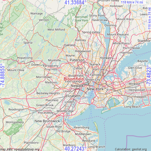
| Upper-left | 41.33684°, | -74.88855° |
| Center: | 40.80677°, | -74.18542° |
| Lower-right: | 40.27243°, | -73.4823° |
| Map W x H: | 118.4×118.4 km | = 73.6×73.6mi |
| max Lat: | 71.29058° ⇑36.7% North |
| Bloomfield: | 40.80677° |
| min Lat: | ⇓63.3% South 19.06759° |
| min Long | Bloomfield | max Long |
| -171.73463° | -74.18542° | -66.98998° |
| W 89.5%⇐ | ⇒10.5% E |
Elevation
Elevation of Bloomfield is 51 m = 167 ft, and this is 243.8 m = 800 ft below average elevation for this country.
| Max E: |
3189 m = 10463 ft | 79% |
| Avg. | 294.8 m = 967 ft | |
| Bloomfield | 51 m = 167 ft | |
Min E: |
-60 m = -197 ft | 21% |
See also: Bloomfield elevation on elevation.city.
Geographical zone
Bloomfield is located in North temperate zone (between Tropic of Cancer and the Arctic Circle). Distance of this Northern Tropic circle is 1931.4 km =1200.1 mi to South.| Distance of | km | miles | from Bloomfield |
|---|---|---|---|
| North Pole | 5469.8 | 3398.8 | to North |
| Arctic Circle | 2863.9 | 1779.5 | to North |
| Tropic Cancer | 1931.4 | 1200.1 | to South |
| Equator | 4537.3 | 2819.3 | to South |


Nearby cities:
15 places around Bloomfield: (largest is in red/bold)
• Belleville
3.3 km =2.1 mi,  116°
116°
• Brookdale
3 km =1.9 mi,  4°
4°
• Cedar Grove
6.2 km =3.9 mi,  323°
323°
• Clifton
6 km =3.7 mi,  17°
17°
• East Orange
4.7 km =2.9 mi,  200°
200°
• Glen Ridge
1.6 km =1 mi,  264°
264°
• Kearny
5.4 km =3.4 mi,  141°
141°
• Lyndhurst
5.2 km =3.2 mi,  83°
83°
• Montclair
2.9 km =1.8 mi, 316°
• North Arlington
4.8 km =3 mi,  114°
114°
• Nutley
2.8 km =1.7 mi,  51°
51°
• Orange
5.7 km =3.5 mi,  224°
224°
• Upper Montclair
4.6 km =2.9 mi,  343°
343°
• Verona
5.3 km =3.3 mi,  299°
299°
• West Orange
4.6 km =2.9 mi, 258°
Sources, notices
• [Note1] Compared only with cities in United States existing in our database
• [Src1] Map data: © OpenStreetMap contributors (CC-BY-SA)
• [Src2] Other city data from geonames.org with taken over terms of usage.
• [Src3] Geographical zone / Annual Mean Temperature by Robert A. Rohde @ Wikipedia
