Lake Telemark geodata
Lake Telemark (New Jersey) is a populated place; located in United States in America/New_York (GMT-4) time zone. With population of 1,255 people, there are 14825 cities with bigger population in this country. Compared to other cities in United States, 65.4% of cities are located further ↓South; 88.5% of cities are located further ←West and 55.8% of cities have lower elevation than Lake Telemark. Note1
Administrative division(s):
- Level 1: New Jersey
- Level 2: Morris County
- Level 3: Township of Rockaway


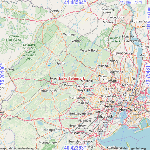
Lake Telemark GPS coordinates[2]
40° 57' 24.372" North, 74° 29' 52.548" West
| Map corner | latitude | longitude |
|---|---|---|
| Upper-left | 41.48564°, | -75.20106° |
| Center: | 40.95677°, | -74.49793° |
| Lower-right: | 40.42363°, | -73.79481° |
| Map W x H: | 118.1×118.1 km | = 73.4×73.4mi |
| max Lat: | 71.29058° ⇑34.6% North |
| Lake Telemark: | 40.95677° |
| min Lat: | ⇓65.4% South 19.06759° |
| min Long | Lake Telemark | max Long |
| -171.73463° | -74.49793° | -66.98998° |
| W 88.5%⇐ | ⇒11.5% E |
Elevation
Elevation of Lake Telemark is 222 m = 728 ft, and this is 72.8 m = 239 ft below average elevation for this country.
| Max E: |
3189 m = 10463 ft | 44.2% |
| Avg. | 294.8 m = 967 ft | |
| Lake Telemark | 222 m = 728 ft | |
Min E: |
-60 m = -197 ft | 55.8% |
See also: United States elevation on elevation.city.
Geographical zone
Lake Telemark is located in North temperate zone (between Tropic of Cancer and the Arctic Circle). Distance of this Northern Tropic circle is 1948 km =1210.4 mi to South.| Distance of | km | miles | from Lake Telemark |
|---|---|---|---|
| North Pole | 5453.1 | 3388.4 | to North |
| Arctic Circle | 2847.2 | 1769.2 | to North |
| Tropic Cancer | 1948 | 1210.4 | to South |
| Equator | 4554 | 2829.7 | to South |


Nearby cities:
15 places around Lake Telemark: (largest is in red/bold)
• Boonton
9.7 km =6 mi,  128°
128°
• Butler
14.1 km =8.8 mi,  68°
68°
• Dover
9.7 km =6 mi,  213°
213°
• Hopatcong
13.8 km =8.6 mi,  258°
258°
• Hopatcong Hills
14.6 km =9.1 mi, 264°
• Kenvil
13.3 km =8.3 mi,  229°
229°
• Kinnelon
12.1 km =7.5 mi, 65°
• Mount Arlington
12 km =7.5 mi,  253°
253°
• Mountain Lakes
8.8 km =5.5 mi,  141°
141°
• Parsippany
12.5 km =7.8 mi,  151°
151°
• Randolph
14 km =8.7 mi, 210°
• Rockaway
6.3 km =3.9 mi,  192°
192°
• Victory Gardens
9.7 km =6 mi,  202°
202°
• Wharton
10 km =6.2 mi,  224°
224°
• White Meadow Lake
3.8 km =2.4 mi, 196°
Sources, notices
• [Note1] Compared only with cities in United States existing in our database
• [Src1] Map data: © OpenStreetMap contributors (CC-BY-SA)
• [Src2] Other city data from geonames.org with taken over terms of usage.
• [Src3] Geographical zone / Annual Mean Temperature by Robert A. Rohde @ Wikipedia
