Cohoes geodata
Cohoes (New York) is a populated place; located in United States in America/New_York (GMT-4) time zone. With population of 16,538 people, there are 2969 cities with bigger population in this country. Compared to other cities in United States, 81.7% of cities are located further ↓South; 92.1% of cities are located further ←West and 83.8% of cities have higher elevation than Cohoes. Note1


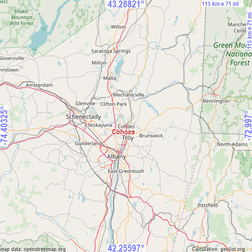
Cohoes GPS coordinates[2]
42° 46' 27.264" North, 73° 42' 0.432" West
| Map corner | latitude | longitude |
|---|---|---|
| Upper-left | 43.28821°, | -74.40325° |
| Center: | 42.77424°, | -73.70012° |
| Lower-right: | 42.25597°, | -72.997° |
| Map W x H: | 114.8×114.8 km | = 71.3×71.3mi |
| max Lat: | 71.29058° ⇑18.3% North |
| Cohoes: | 42.77424° |
| min Lat: | ⇓81.7% South 19.06759° |
| min Long | Cohoes | max Long |
| -171.73463° | -73.70012° | -66.98998° |
| W 92.1%⇐ | ⇒7.9% E |
Elevation
Elevation of Cohoes is 32 m = 105 ft, and this is 262.8 m = 862 ft below average elevation for this country.
| Max E: |
3189 m = 10463 ft | 83.8% |
| Avg. | 294.8 m = 967 ft | |
| Cohoes | 32 m = 105 ft | |
Min E: |
-60 m = -197 ft | 16.2% |
See also: United States elevation on elevation.city.
Geographical zone
Cohoes is located in North temperate zone (between Tropic of Cancer and the Arctic Circle). Distance of this Northern Tropic circle is 2150.1 km =1336 mi to South.| Distance of | km | miles | from Cohoes |
|---|---|---|---|
| North Pole | 5251 | 3262.8 | to North |
| Arctic Circle | 2645.1 | 1643.6 | to North |
| Tropic Cancer | 2150.1 | 1336 | to South |
| Equator | 4756 | 2955.2 | to South |


Nearby cities:
15 places around Cohoes: (largest is in red/bold)
• Albany
14.3 km =8.9 mi,  198°
198°
• Colonie
12.6 km =7.8 mi,  240°
240°
• Green Island
3.4 km =2.1 mi,  168°
168°
• Latham
5.7 km =3.5 mi, 237°
• Mechanicville
14.3 km =8.9 mi,  4°
4°
• Menands
9.4 km =5.8 mi,  192°
192°
• Niskayuna
11.9 km =7.4 mi,  272°
272°
• Poestenkill
14.5 km =9 mi,  130°
130°
• Rensselaer
15.1 km =9.4 mi, 193°
• Roessleville
12.4 km =7.7 mi,  224°
224°
• Troy
5.1 km =3.2 mi, 172°
• Waterford
2.6 km =1.6 mi,  37°
37°
• Watervliet
4.9 km =3 mi,  181°
181°
• West Albany
12 km =7.5 mi,  212°
212°
• Wynantskill
9.7 km =6 mi,  152°
152°
Sources, notices
• [Note1] Compared only with cities in United States existing in our database
• [Src1] Map data: © OpenStreetMap contributors (CC-BY-SA)
• [Src2] Other city data from geonames.org with taken over terms of usage.
• [Src3] Geographical zone / Annual Mean Temperature by Robert A. Rohde @ Wikipedia
