Hastings-on-Hudson geodata
Hastings-on-Hudson (New York) is a populated place; located in United States in America/New_York (GMT-4) time zone. With population of 8,014 people, there are 5273 cities with bigger population in this country. Compared to other cities in United States, 65.8% of cities are located further ↓South; 91.3% of cities are located further ←West and 79.3% of cities have higher elevation than Hastings-on-Hudson. Note1


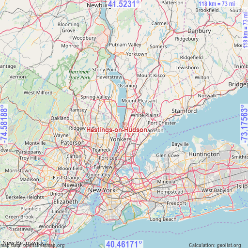
Hastings-on-Hudson GPS coordinates[2]
40° 59' 40.344" North, 73° 52' 43.5" West
| Map corner | latitude | longitude |
|---|---|---|
| Upper-left | 41.5231°, | -74.58188° |
| Center: | 40.99454°, | -73.87875° |
| Lower-right: | 40.46171°, | -73.17563° |
| Map W x H: | 118×118 km | = 73.3×73.3mi |
| max Lat: | 71.29058° ⇑34.2% North |
| Hastings-on-Hudson: | 40.99454° |
| min Lat: | ⇓65.8% South 19.06759° |
| min Long | Hastings-on-Hud | max Long |
| -171.73463° | -73.87875° | -66.98998° |
| W 91.3%⇐ | ⇒8.7% E |
Elevation
Elevation of Hastings-on-Hudson is 50 m = 164 ft, and this is 244.8 m = 803 ft below average elevation for this country.
| Max E: |
3189 m = 10463 ft | 79.3% |
| Avg. | 294.8 m = 967 ft | |
| Hastings-on-Hudson | 50 m = 164 ft | |
Min E: |
-60 m = -197 ft | 20.7% |
See also: United States elevation on elevation.city.
Geographical zone
Hastings-on-Hudson is located in North temperate zone (between Tropic of Cancer and the Arctic Circle). Distance of this Northern Tropic circle is 1952.2 km =1213 mi to South.| Distance of | km | miles | from Hastings-on-Hudson |
|---|---|---|---|
| North Pole | 5448.9 | 3385.8 | to North |
| Arctic Circle | 2843 | 1766.6 | to North |
| Tropic Cancer | 1952.2 | 1213 | to South |
| Equator | 4558.2 | 2832.3 | to South |


Nearby cities:
15 places around Hastings-on-Hudson: (largest is in red/bold)
• Alpine
6.2 km =3.9 mi,  225°
225°
• Ardsley
3.4 km =2.1 mi,  58°
58°
• Dobbs Ferry
2.3 km =1.4 mi,  12°
12°
• Eastchester
7.1 km =4.4 mi,  124°
124°
• Greenburgh
5.2 km =3.2 mi,  35°
35°
• Greenville
4.9 km =3 mi,  91°
91°
• Irvington
5 km =3.1 mi, 10°
• Northvale
6 km =3.7 mi,  282°
282°
• Norwood
7 km =4.3 mi,  273°
273°
• Piermont
6.2 km =3.9 mi,  327°
327°
• Rockleigh
4.4 km =2.7 mi, 278°
• Sparkill
5.8 km =3.6 mi,  315°
315°
• Tappan
6.5 km =4 mi,  297°
297°
• Tuckahoe
6.5 km =4 mi,  138°
138°
• Yonkers
7.2 km =4.5 mi,  193°
193°
Sources, notices
• [Note1] Compared only with cities in United States existing in our database
• [Src1] Map data: © OpenStreetMap contributors (CC-BY-SA)
• [Src2] Other city data from geonames.org with taken over terms of usage.
• [Src3] Geographical zone / Annual Mean Temperature by Robert A. Rohde @ Wikipedia
