Little Valley geodata
Little Valley (New York) is a seat of a second-order administrative division; located in United States in America/New_York (GMT-4) time zone. With population of 1,105 people, there are 15644 cities with bigger population in this country. Compared to other cities in United States, 77.8% of cities are located further ↓South; 76.3% of cities are located further ←West and 87.6% of cities have lower elevation than Little Valley. Note1
Administrative division(s):
- Level 1: New York
- Level 2: Cattaraugus County
- Level 3: Town of Little Valley


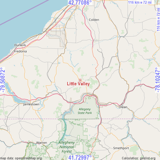
Little Valley GPS coordinates[2]
42° 15' 9.216" North, 78° 48' 20.124" West
| Map corner | latitude | longitude |
|---|---|---|
| Upper-left | 42.77086°, | -79.50872° |
| Center: | 42.25256°, | -78.80559° |
| Lower-right: | 41.72997°, | -78.10247° |
| Map W x H: | 115.7×115.7 km | = 71.9×71.9mi |
| max Lat: | 71.29058° ⇑22.2% North |
| Little Valley: | 42.25256° |
| min Lat: | ⇓77.8% South 19.06759° |
| min Long | Little Valley | max Long |
| -171.73463° | -78.80559° | -66.98998° |
| W 76.3%⇐ | ⇒23.7% E |
Elevation
Elevation of Little Valley is 489 m = 1604 ft, and this is 194.2 m = 637 ft above average elevation for this country.
| Max E: |
3189 m = 10463 ft | 12.4% |
| Little Valley | 489 m 1604 ft | |
| Avg. | 294.8 m = 967 ft | |
Min E: |
-60 m = -197 ft | 87.6% |
See also: United States elevation on elevation.city.
Geographical zone
Little Valley is located in North temperate zone (between Tropic of Cancer and the Arctic Circle). Distance of this Northern Tropic circle is 2092.1 km =1300 mi to South.| Distance of | km | miles | from Little Valley |
|---|---|---|---|
| North Pole | 5309 | 3298.9 | to North |
| Arctic Circle | 2703.1 | 1679.6 | to North |
| Tropic Cancer | 2092.1 | 1300 | to South |
| Equator | 4698 | 2919.2 | to South |


Nearby cities:
15 places around Little Valley: (largest is in red/bold)
• Allegany
31.4 km =19.5 mi,  125°
125°
• Bradford
35.6 km =22.1 mi,  157°
157°
• Cattaraugus
10 km =6.2 mi,  328°
328°
• East Randolph
14.7 km =9.1 mi,  232°
232°
• Falconer
35.6 km =22.1 mi,  245°
245°
• Foster Brook
34.5 km =21.4 mi,  153°
153°
• Franklinville
30.1 km =18.7 mi,  71°
71°
• Gowanda
25.7 km =16 mi,  335°
335°
• Lime Lake
33.6 km =20.9 mi,  52°
52°
• Randolph
17.2 km =10.7 mi, 234°
• Saint Bonaventure
33.3 km =20.7 mi, 125°
• Salamanca
12.9 km =8 mi,  144°
144°
• South Dayton
24 km =14.9 mi,  301°
301°
• Springville
30.6 km =19 mi,  21°
21°
• West Valley
23.2 km =14.4 mi,  43°
43°
Sources, notices
• [Note1] Compared only with cities in United States existing in our database
• [Src1] Map data: © OpenStreetMap contributors (CC-BY-SA)
• [Src2] Other city data from geonames.org with taken over terms of usage.
• [Src3] Geographical zone / Annual Mean Temperature by Robert A. Rohde @ Wikipedia
