Oneonta geodata
Oneonta (New York) is a populated place; located in United States in America/New_York (GMT-4) time zone. With population of 13,862 people, there are 3468 cities with bigger population in this country. Compared to other cities in United States, 79.4% of cities are located further ↓South; 87.1% of cities are located further ←West and 78.8% of cities have lower elevation than Oneonta. Note1


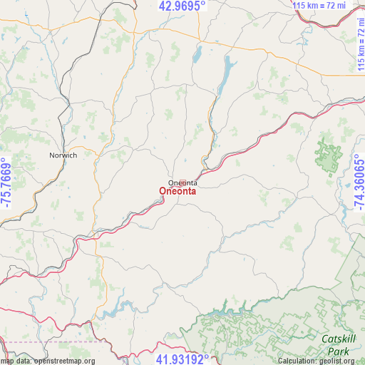
Oneonta GPS coordinates[2]
42° 27' 10.296" North, 75° 3' 49.572" West
| Map corner | latitude | longitude |
|---|---|---|
| Upper-left | 42.9695°, | -75.7669° |
| Center: | 42.45286°, | -75.06377° |
| Lower-right: | 41.93192°, | -74.36065° |
| Map W x H: | 115.4×115.4 km | = 71.7×71.7mi |
| max Lat: | 71.29058° ⇑20.6% North |
| Oneonta: | 42.45286° |
| min Lat: | ⇓79.4% South 19.06759° |
| min Long | Oneonta | max Long |
| -171.73463° | -75.06377° | -66.98998° |
| W 87.1%⇐ | ⇒12.9% E |
Elevation
Elevation of Oneonta is 343 m = 1125 ft, and this is 48.2 m = 158 ft above average elevation for this country.
| Max E: |
3189 m = 10463 ft | 21.2% |
| Oneonta | 343 m 1125 ft | |
| Avg. | 294.8 m = 967 ft | |
Min E: |
-60 m = -197 ft | 78.8% |
See also: United States elevation on elevation.city.
Geographical zone
Oneonta is located in North temperate zone (between Tropic of Cancer and the Arctic Circle). Distance of this Northern Tropic circle is 2114.4 km =1313.8 mi to South.| Distance of | km | miles | from Oneonta |
|---|---|---|---|
| North Pole | 5286.7 | 3285 | to North |
| Arctic Circle | 2680.9 | 1665.8 | to North |
| Tropic Cancer | 2114.4 | 1313.8 | to South |
| Equator | 4720.3 | 2933.1 | to South |


Nearby cities:
15 places around Oneonta: (largest is in red/bold)
• Columbus
36.1 km =22.4 mi,  315°
315°
• Cooperstown
29.8 km =18.5 mi,  22°
22°
• Delhi
22.9 km =14.2 mi,  147°
147°
• Edmeston
31 km =19.3 mi,  331°
331°
• Hartwick
23 km =14.3 mi,  3°
3°
• Morris
18.3 km =11.4 mi,  305°
305°
• New Berlin
29.1 km =18.1 mi, 310°
• Otego
10.9 km =6.8 mi,  235°
235°
• Schenevus
22.6 km =14 mi,  61°
61°
• Sidney
31 km =19.3 mi, 240°
• Stamford
37.2 km =23.1 mi,  97°
97°
• Unadilla
24.9 km =15.5 mi, 235°
• Walton
32 km =19.9 mi,  189°
189°
• West End
3 km =1.9 mi, 305°
• Worcester
29.9 km =18.6 mi, 59°
Sources, notices
• [Note1] Compared only with cities in United States existing in our database
• [Src1] Map data: © OpenStreetMap contributors (CC-BY-SA)
• [Src2] Other city data from geonames.org with taken over terms of usage.
• [Src3] Geographical zone / Annual Mean Temperature by Robert A. Rohde @ Wikipedia
