Poughkeepsie geodata
Poughkeepsie (New York) is a seat of a second-order administrative division; located in United States in America/New_York (GMT-4) time zone. With population of 30,371 people, there are 1649 cities with bigger population in this country. Compared to other cities in United States, 73% of cities are located further ↓South; 91% of cities are located further ←West and 76.9% of cities have higher elevation than Poughkeepsie. Note1
Administrative division(s):
- Level 1: New York
- Level 2: Dutchess County
- Level 3: City of Poughkeepsie


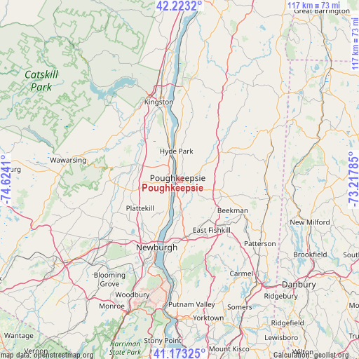
Poughkeepsie GPS coordinates[2]
41° 42' 1.332" North, 73° 55' 15.492" West
| Map corner | latitude | longitude |
|---|---|---|
| Upper-left | 42.2232°, | -74.6241° |
| Center: | 41.70037°, | -73.92097° |
| Lower-right: | 41.17325°, | -73.21785° |
| Map W x H: | 116.7×116.7 km | = 72.5×72.5mi |
| max Lat: | 71.29058° ⇑27% North |
| Poughkeepsie: | 41.70037° |
| min Lat: | ⇓73% South 19.06759° |
| min Long | Poughkeepsie | max Long |
| -171.73463° | -73.92097° | -66.98998° |
| W 91%⇐ | ⇒9% E |
Elevation
Elevation of Poughkeepsie is 61 m = 200 ft, and this is 233.8 m = 767 ft below average elevation for this country.
| Max E: |
3189 m = 10463 ft | 76.9% |
| Avg. | 294.8 m = 967 ft | |
| Poughkeepsie | 61 m = 200 ft | |
Min E: |
-60 m = -197 ft | 23.1% |
See also: United States elevation on elevation.city.
Geographical zone
Poughkeepsie is located in North temperate zone (between Tropic of Cancer and the Arctic Circle). Distance of this Northern Tropic circle is 2030.7 km =1261.8 mi to South.| Distance of | km | miles | from Poughkeepsie |
|---|---|---|---|
| North Pole | 5370.4 | 3337 | to North |
| Arctic Circle | 2764.5 | 1717.8 | to North |
| Tropic Cancer | 2030.7 | 1261.8 | to South |
| Equator | 4636.6 | 2881 | to South |


Nearby cities:
15 places around Poughkeepsie: (largest is in red/bold)
• Arlington
2.1 km =1.3 mi,  103°
103°
• Clintondale
10.8 km =6.7 mi,  266°
266°
• Crown Heights
7.2 km =4.5 mi,  191°
191°
• Fairview
2.6 km =1.6 mi,  2°
2°
• Haviland
7.6 km =4.7 mi,  12°
12°
• Highland
4 km =2.5 mi,  305°
305°
• Hyde Park
9.4 km =5.8 mi,  353°
353°
• Marlboro
11.3 km =7 mi,  201°
201°
• Milton
5.4 km =3.4 mi,  213°
213°
• Myers Corner
11.2 km =7 mi,  159°
159°
• Pleasant Valley
9.6 km =6 mi,  59°
59°
• Red Oaks Mill
6.3 km =3.9 mi,  142°
142°
• Spackenkill
5 km =3.1 mi,  172°
172°
• Titusville
5.3 km =3.3 mi,  133°
133°
• Wappingers Falls
11.6 km =7.2 mi,  175°
175°
Sources, notices
• [Note1] Compared only with cities in United States existing in our database
• [Src1] Map data: © OpenStreetMap contributors (CC-BY-SA)
• [Src2] Other city data from geonames.org with taken over terms of usage.
• [Src3] Geographical zone / Annual Mean Temperature by Robert A. Rohde @ Wikipedia
