Akron geodata
Akron (Ohio) is a seat of a second-order administrative division; located in United States in America/New_York (GMT-4) time zone. With population of 197,542 people, there are 132 cities with bigger population in this country. Compared to other cities in United States, 66.7% of cities are located further ↓South; 67.5% of cities are located further ←West and 71.8% of cities have lower elevation than Akron. Note1


Akron GPS coordinates[2]
41° 4' 53.184" North, 81° 31' 8.436" West
| Map corner | latitude | longitude |
|---|---|---|
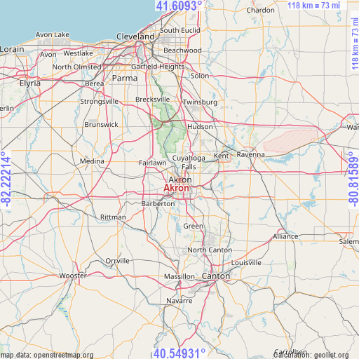
| Upper-left | 41.6093°, | -82.22214° |
| Center: | 41.08144°, | -81.51901° |
| Lower-right: | 40.54931°, | -80.81589° |
| Map W x H: | 117.9×117.9 km | = 73.3×73.3mi |
| max Lat: | 71.29058° ⇑33.3% North |
| Akron: | 41.08144° |
| min Lat: | ⇓66.7% South 19.06759° |
| min Long | Akron | max Long |
| -171.73463° | -81.51901° | -66.98998° |
| W 67.5%⇐ | ⇒32.5% E |
Elevation
Elevation of Akron is 295 m = 968 ft, and this is 0.19999999999999 m = 1 ft above average elevation for this country.
| Max E: |
3189 m = 10463 ft | 28.2% |
| Akron | 295 m 968 ft | |
| Avg. | 294.8 m = 967 ft | |
Min E: |
-60 m = -197 ft | 71.8% |
See also: Akron elevation on elevation.city.
Geographical zone
Akron is located in North temperate zone (between Tropic of Cancer and the Arctic Circle). Distance of this Northern Tropic circle is 1961.9 km =1219.1 mi to South.| Distance of | km | miles | from Akron |
|---|---|---|---|
| North Pole | 5439.2 | 3379.8 | to North |
| Arctic Circle | 2833.3 | 1760.5 | to North |
| Tropic Cancer | 1961.9 | 1219.1 | to South |
| Equator | 4567.8 | 2838.3 | to South |


Nearby cities:
15 places around Akron: (largest is in red/bold)
• Barberton
10.5 km =6.5 mi,  223°
223°
• Copley
10.7 km =6.6 mi,  280°
280°
• Cuyahoga Falls
6.5 km =4 mi,  26°
26°
• Fairlawn
9.2 km =5.7 mi,  304°
304°
• Lakemore
9.7 km =6 mi,  134°
134°
• Mogadore
10.9 km =6.8 mi,  110°
110°
• Montrose-Ghent
13.2 km =8.2 mi,  307°
307°
• Munroe Falls
9.7 km =6 mi,  43°
43°
• Norton
11.6 km =7.2 mi,  239°
239°
• Pigeon Creek
13.3 km =8.3 mi, 284°
• Portage Lakes
8.3 km =5.2 mi,  184°
184°
• Sawyerwood
8.1 km =5 mi, 126°
• Silver Lake
10.2 km =6.3 mi, 32°
• Stow
10.9 km =6.8 mi, 37°
• Tallmadge
6.8 km =4.2 mi,  71°
71°
Sources, notices
• [Note1] Compared only with cities in United States existing in our database
• [Src1] Map data: © OpenStreetMap contributors (CC-BY-SA)
• [Src2] Other city data from geonames.org with taken over terms of usage.
• [Src3] Geographical zone / Annual Mean Temperature by Robert A. Rohde @ Wikipedia
