Sawyerwood geodata
Sawyerwood (Ohio) is a populated place; located in United States in America/New_York (GMT-4) time zone. With population of 1,540 people, there are 13510 cities with bigger population in this country. Compared to other cities in United States, 66.3% of cities are located further ↓South; 67.9% of cities are located further ←West and 78% of cities have lower elevation than Sawyerwood. Note1


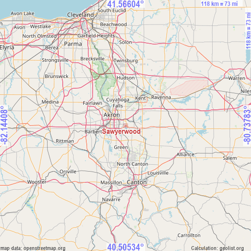
Sawyerwood GPS coordinates[2]
41° 2' 16.188" North, 81° 26' 27.42" West
| Map corner | latitude | longitude |
|---|---|---|
| Upper-left | 41.56604°, | -82.14408° |
| Center: | 41.03783°, | -81.44095° |
| Lower-right: | 40.50534°, | -80.73783° |
| Map W x H: | 117.9×117.9 km | = 73.3×73.3mi |
| max Lat: | 71.29058° ⇑33.7% North |
| Sawyerwood: | 41.03783° |
| min Lat: | ⇓66.3% South 19.06759° |
| min Long | Sawyerwood | max Long |
| -171.73463° | -81.44095° | -66.98998° |
| W 67.9%⇐ | ⇒32.1% E |
Elevation
Elevation of Sawyerwood is 336 m = 1102 ft, and this is 41.2 m = 135 ft above average elevation for this country.
| Max E: |
3189 m = 10463 ft | 22% |
| Sawyerwood | 336 m 1102 ft | |
| Avg. | 294.8 m = 967 ft | |
Min E: |
-60 m = -197 ft | 78% |
See also: United States elevation on elevation.city.
Geographical zone
Sawyerwood is located in North temperate zone (between Tropic of Cancer and the Arctic Circle). Distance of this Northern Tropic circle is 1957.1 km =1216.1 mi to South.| Distance of | km | miles | from Sawyerwood |
|---|---|---|---|
| North Pole | 5444.1 | 3382.8 | to North |
| Arctic Circle | 2838.2 | 1763.6 | to North |
| Tropic Cancer | 1957.1 | 1216.1 | to South |
| Equator | 4563 | 2835.3 | to South |


Nearby cities:
15 places around Sawyerwood: (largest is in red/bold)
• Akron
8.1 km =5 mi,  306°
306°
• Brimfield
10.5 km =6.5 mi,  48°
48°
• Cuyahoga Falls
11.3 km =7 mi,  341°
341°
• Green
10.8 km =6.7 mi,  199°
199°
• Greensburg
12 km =7.5 mi,  189°
189°
• Greentown
12.7 km =7.9 mi,  165°
165°
• Hartville
12.4 km =7.7 mi,  131°
131°
• Lakemore
1.9 km =1.2 mi, 167°
• Mogadore
3.7 km =2.3 mi,  75°
75°
• Munroe Falls
11.9 km =7.4 mi,  0°
0°
• Portage Lakes
8 km =5 mi,  244°
244°
• Silver Lake
13.5 km =8.4 mi,  355°
355°
• Stow
13.5 km =8.4 mi, 0°
• Tallmadge
7.1 km =4.4 mi, 359°
• Uniontown
7.5 km =4.7 mi,  158°
158°
Sources, notices
• [Note1] Compared only with cities in United States existing in our database
• [Src1] Map data: © OpenStreetMap contributors (CC-BY-SA)
• [Src2] Other city data from geonames.org with taken over terms of usage.
• [Src3] Geographical zone / Annual Mean Temperature by Robert A. Rohde @ Wikipedia
