Minerva geodata
Minerva (Ohio) is a populated place; located in United States in America/New_York (GMT-4) time zone. With population of 3,678 people, there are 8622 cities with bigger population in this country. Compared to other cities in United States, 62% of cities are located further ↓South; 69.1% of cities are located further ←West and 76.4% of cities have lower elevation than Minerva. Note1


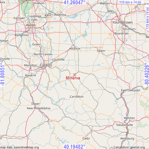
Minerva GPS coordinates[2]
40° 43' 47.208" North, 81° 6' 19.368" West
| Map corner | latitude | longitude |
|---|---|---|
| Upper-left | 41.26047°, | -81.80851° |
| Center: | 40.72978°, | -81.10538° |
| Lower-right: | 40.19482°, | -80.40226° |
| Map W x H: | 118.5×118.5 km | = 73.6×73.6mi |
| max Lat: | 71.29058° ⇑38% North |
| Minerva: | 40.72978° |
| min Lat: | ⇓62% South 19.06759° |
| min Long | Minerva | max Long |
| -171.73463° | -81.10538° | -66.98998° |
| W 69.1%⇐ | ⇒30.9% E |
Elevation
Elevation of Minerva is 323 m = 1060 ft, and this is 28.2 m = 93 ft above average elevation for this country.
| Max E: |
3189 m = 10463 ft | 23.6% |
| Minerva | 323 m 1060 ft | |
| Avg. | 294.8 m = 967 ft | |
Min E: |
-60 m = -197 ft | 76.4% |
See also: United States elevation on elevation.city.
Geographical zone
Minerva is located in North temperate zone (between Tropic of Cancer and the Arctic Circle). Distance of this Northern Tropic circle is 1922.8 km =1194.8 mi to South.| Distance of | km | miles | from Minerva |
|---|---|---|---|
| North Pole | 5478.3 | 3404.1 | to North |
| Arctic Circle | 2872.4 | 1784.8 | to North |
| Tropic Cancer | 1922.8 | 1194.8 | to South |
| Equator | 4528.7 | 2814 | to South |


Nearby cities:
15 places around Minerva: (largest is in red/bold)
• Alliance
20.6 km =12.8 mi,  359°
359°
• Beloit
23.5 km =14.6 mi,  23°
23°
• Canton
24.2 km =15 mi,  288°
288°
• Carrollton
17.5 km =10.9 mi,  174°
174°
• East Canton
16.2 km =10.1 mi, 293°
• East Sparta
22.1 km =13.7 mi,  251°
251°
• Lake Mohawk
10.6 km =6.6 mi,  228°
228°
• Louisville
17.6 km =10.9 mi,  312°
312°
• Magnolia
18.5 km =11.5 mi,  241°
241°
• Malvern
7.7 km =4.8 mi, 236°
• Maple Ridge
22 km =13.7 mi,  12°
12°
• Mineral City
25.9 km =16.1 mi, 236°
• Salineville
25.5 km =15.8 mi,  117°
117°
• Sebring
22.7 km =14.1 mi, 18°
• Waynesburg
14.5 km =9 mi, 241°
Sources, notices
• [Note1] Compared only with cities in United States existing in our database
• [Src1] Map data: © OpenStreetMap contributors (CC-BY-SA)
• [Src2] Other city data from geonames.org with taken over terms of usage.
• [Src3] Geographical zone / Annual Mean Temperature by Robert A. Rohde @ Wikipedia
