Strongsville geodata
Strongsville (Ohio) is a populated place; located in United States in America/New_York (GMT-4) time zone. With population of 44,668 people, there are 1066 cities with bigger population in this country. Compared to other cities in United States, 69% of cities are located further ↓South; 66.2% of cities are located further ←West and 69.5% of cities have lower elevation than Strongsville. Note1


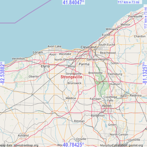
Strongsville GPS coordinates[2]
41° 18' 52.2" North, 81° 50' 8.484" West
| Map corner | latitude | longitude |
|---|---|---|
| Upper-left | 41.84047°, | -82.53882° |
| Center: | 41.3145°, | -81.83569° |
| Lower-right: | 40.78425°, | -81.13257° |
| Map W x H: | 117.4×117.4 km | = 72.9×72.9mi |
| max Lat: | 71.29058° ⇑31% North |
| Strongsville: | 41.3145° |
| min Lat: | ⇓69% South 19.06759° |
| min Long | Strongsville | max Long |
| -171.73463° | -81.83569° | -66.98998° |
| W 66.2%⇐ | ⇒33.8% E |
Elevation
Elevation of Strongsville is 283 m = 928 ft, and this is 11.8 m = 39 ft below average elevation for this country.
| Max E: |
3189 m = 10463 ft | 30.5% |
| Avg. | 294.8 m = 967 ft | |
| Strongsville | 283 m = 928 ft | |
Min E: |
-60 m = -197 ft | 69.5% |
See also: Strongsville elevation on elevation.city.
Geographical zone
Strongsville is located in North temperate zone (between Tropic of Cancer and the Arctic Circle). Distance of this Northern Tropic circle is 1987.8 km =1235.2 mi to South.| Distance of | km | miles | from Strongsville |
|---|---|---|---|
| North Pole | 5413.3 | 3363.7 | to North |
| Arctic Circle | 2807.4 | 1744.4 | to North |
| Tropic Cancer | 1987.8 | 1235.2 | to South |
| Equator | 4593.7 | 2854.4 | to South |


Nearby cities:
15 places around Strongsville: (largest is in red/bold)
• Berea
6 km =3.7 mi,  344°
344°
• Broadview Heights
12.6 km =7.8 mi,  90°
90°
• Brook Park
9.7 km =6 mi,  15°
15°
• Brooklyn
16.2 km =10.1 mi,  30°
30°
• Brunswick
8.5 km =5.3 mi,  183°
183°
• Eaton Estates
14.2 km =8.8 mi,  267°
267°
• Fairview Park
14.3 km =8.9 mi,  350°
350°
• Middleburg Heights
5.6 km =3.5 mi, 20°
• North Olmsted
13.4 km =8.3 mi,  326°
326°
• North Royalton
9.3 km =5.8 mi, 90°
• Olmsted Falls
9.1 km =5.7 mi,  318°
318°
• Parma
13.8 km =8.6 mi,  43°
43°
• Parma Heights
10.5 km =6.5 mi, 37°
• Seven Hills
16.1 km =10 mi,  55°
55°
• Westlake
17.1 km =10.6 mi, 336°
Sources, notices
• [Note1] Compared only with cities in United States existing in our database
• [Src1] Map data: © OpenStreetMap contributors (CC-BY-SA)
• [Src2] Other city data from geonames.org with taken over terms of usage.
• [Src3] Geographical zone / Annual Mean Temperature by Robert A. Rohde @ Wikipedia
