Duncansville geodata
Duncansville (Pennsylvania) is a populated place; located in United States in America/New_York (GMT-4) time zone. With population of 1,204 people, there are 15109 cities with bigger population in this country. Compared to other cities in United States, 58.2% of cities are located further ↓South; 77% of cities are located further ←West and 74.9% of cities have lower elevation than Duncansville. Note1
Administrative division(s):
- Level 1: Pennsylvania
- Level 2: Blair County
- Level 3: Borough of Duncansville


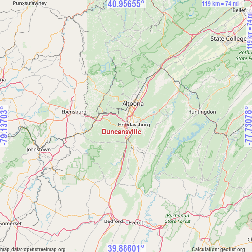
Duncansville GPS coordinates[2]
40° 25' 24.276" North, 78° 26' 2.04" West
| Map corner | latitude | longitude |
|---|---|---|
| Upper-left | 40.95655°, | -79.13703° |
| Center: | 40.42341°, | -78.4339° |
| Lower-right: | 39.88601°, | -77.73078° |
| Map W x H: | 119×119 km | = 73.9×73.9mi |
| max Lat: | 71.29058° ⇑41.8% North |
| Duncansville: | 40.42341° |
| min Lat: | ⇓58.2% South 19.06759° |
| min Long | Duncansville | max Long |
| -171.73463° | -78.4339° | -66.98998° |
| W 77%⇐ | ⇒23% E |
Elevation
Elevation of Duncansville is 312 m = 1024 ft, and this is 17.2 m = 56 ft above average elevation for this country.
| Max E: |
3189 m = 10463 ft | 25.1% |
| Duncansville | 312 m 1024 ft | |
| Avg. | 294.8 m = 967 ft | |
Min E: |
-60 m = -197 ft | 74.9% |
See also: United States elevation on elevation.city.
Geographical zone
Duncansville is located in North temperate zone (between Tropic of Cancer and the Arctic Circle). Distance of this Northern Tropic circle is 1888.7 km =1173.6 mi to South.| Distance of | km | miles | from Duncansville |
|---|---|---|---|
| North Pole | 5512.4 | 3425.2 | to North |
| Arctic Circle | 2906.5 | 1806 | to North |
| Tropic Cancer | 1888.7 | 1173.6 | to South |
| Equator | 4494.7 | 2792.9 | to South |


Nearby cities:
15 places around Duncansville: (largest is in red/bold)
• Altoona
11.1 km =6.9 mi,  17°
17°
• Claysburg
14.1 km =8.8 mi,  185°
185°
• Cresson
14 km =8.7 mi,  286°
286°
• East Freedom
7.3 km =4.5 mi,  177°
177°
• Foot of Ten
2 km =1.2 mi,  245°
245°
• Gallitzin
11.9 km =7.4 mi,  303°
303°
• Greenwood
14.1 km =8.8 mi,  27°
27°
• Hollidaysburg
3.8 km =2.4 mi,  83°
83°
• Lakemont
6.7 km =4.2 mi,  35°
35°
• Lilly
15.8 km =9.8 mi,  271°
271°
• Loretto
18.8 km =11.7 mi, 298°
• Martinsburg
15.6 km =9.7 mi,  143°
143°
• Roaring Spring
10.4 km =6.5 mi,  159°
159°
• Sankertown
14.4 km =8.9 mi, 291°
• Williamsburg
20.3 km =12.6 mi, 77°
Sources, notices
• [Note1] Compared only with cities in United States existing in our database
• [Src1] Map data: © OpenStreetMap contributors (CC-BY-SA)
• [Src2] Other city data from geonames.org with taken over terms of usage.
• [Src3] Geographical zone / Annual Mean Temperature by Robert A. Rohde @ Wikipedia
