Industry geodata
Industry (Pennsylvania) is a populated place; located in United States in America/New_York (GMT-4) time zone. With population of 1,791 people, there are 12574 cities with bigger population in this country. Compared to other cities in United States, 60.7% of cities are located further ↓South; 71.1% of cities are located further ←West and 53.5% of cities have lower elevation than Industry. Note1
Administrative division(s):
- Level 1: Pennsylvania
- Level 2: Beaver County
- Level 3: Borough of Industry


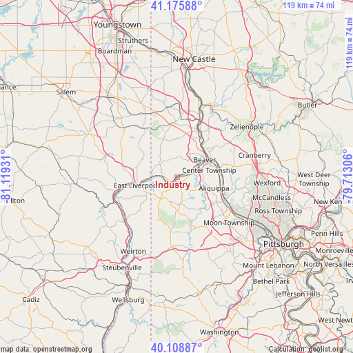
Industry GPS coordinates[2]
40° 38' 40.236" North, 80° 24' 58.248" West
| Map corner | latitude | longitude |
|---|---|---|
| Upper-left | 41.17588°, | -81.11931° |
| Center: | 40.64451°, | -80.41618° |
| Lower-right: | 40.10887°, | -79.71306° |
| Map W x H: | 118.6×118.6 km | = 73.7×73.7mi |
| max Lat: | 71.29058° ⇑39.3% North |
| Industry: | 40.64451° |
| min Lat: | ⇓60.7% South 19.06759° |
| min Long | Industry | max Long |
| -171.73463° | -80.41618° | -66.98998° |
| W 71.1%⇐ | ⇒28.9% E |
Elevation
Elevation of Industry is 212 m = 696 ft, and this is 82.8 m = 272 ft below average elevation for this country.
| Max E: |
3189 m = 10463 ft | 46.5% |
| Avg. | 294.8 m = 967 ft | |
| Industry | 212 m = 696 ft | |
Min E: |
-60 m = -197 ft | 53.5% |
See also: United States elevation on elevation.city.
Geographical zone
Industry is located in North temperate zone (between Tropic of Cancer and the Arctic Circle). Distance of this Northern Tropic circle is 1913.3 km =1188.9 mi to South.| Distance of | km | miles | from Industry |
|---|---|---|---|
| North Pole | 5487.8 | 3410 | to North |
| Arctic Circle | 2881.9 | 1790.7 | to North |
| Tropic Cancer | 1913.3 | 1188.9 | to South |
| Equator | 4519.2 | 2808.1 | to South |


Nearby cities:
15 places around Industry: (largest is in red/bold)
• Aliquippa
14.9 km =9.3 mi,  93°
93°
• Beaver
11 km =6.8 mi,  58°
58°
• Beaver Falls
14.5 km =9 mi,  34°
34°
• Bridgewater
11.8 km =7.3 mi, 55°
• Calcutta
13.9 km =8.6 mi,  283°
283°
• Chester
12.9 km =8 mi,  254°
254°
• East Liverpool
13.9 km =8.6 mi,  258°
258°
• East Rochester
13.9 km =8.6 mi, 63°
• Freedom
14.6 km =9.1 mi,  71°
71°
• Midland
2.9 km =1.8 mi,  242°
242°
• Monaca
13.1 km =8.1 mi, 68°
• New Brighton
13.1 km =8.1 mi,  43°
43°
• Ohioville
7.7 km =4.8 mi,  300°
300°
• Patterson Heights
12.9 km =8 mi, 34°
• Rochester
12.7 km =7.9 mi, 59°
Sources, notices
• [Note1] Compared only with cities in United States existing in our database
• [Src1] Map data: © OpenStreetMap contributors (CC-BY-SA)
• [Src2] Other city data from geonames.org with taken over terms of usage.
• [Src3] Geographical zone / Annual Mean Temperature by Robert A. Rohde @ Wikipedia
