Knoxville geodata
Knoxville (Pennsylvania) is a populated place; located in United States in America/New_York (GMT-4) time zone. With population of 622 people, there are 19448 cities with bigger population in this country. Compared to other cities in United States, 75.3% of cities are located further ↓South; 79.1% of cities are located further ←West and 82.5% of cities have lower elevation than Knoxville. Note1
Administrative division(s):
- Level 1: Pennsylvania
- Level 2: Tioga County
- Level 3: Borough of Knoxville


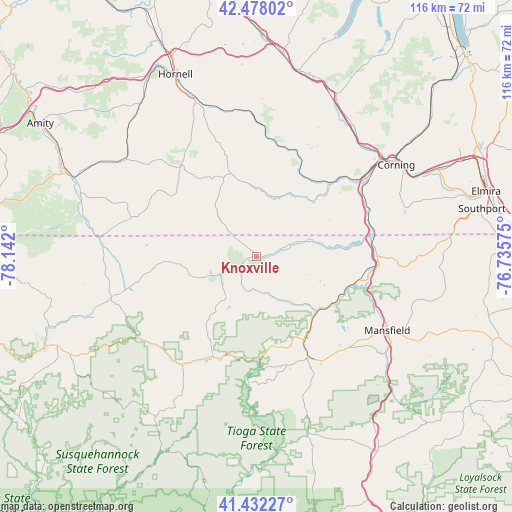
Knoxville GPS coordinates[2]
41° 57' 26.244" North, 77° 26' 19.932" West
| Map corner | latitude | longitude |
|---|---|---|
| Upper-left | 42.47802°, | -78.142° |
| Center: | 41.95729°, | -77.43887° |
| Lower-right: | 41.43227°, | -76.73575° |
| Map W x H: | 116.3×116.3 km | = 72.3×72.3mi |
| max Lat: | 71.29058° ⇑24.7% North |
| Knoxville: | 41.95729° |
| min Lat: | ⇓75.3% South 19.06759° |
| min Long | Knoxville | max Long |
| -171.73463° | -77.43887° | -66.98998° |
| W 79.1%⇐ | ⇒20.9% E |
Elevation
Elevation of Knoxville is 382 m = 1253 ft, and this is 87.2 m = 286 ft above average elevation for this country.
| Max E: |
3189 m = 10463 ft | 17.5% |
| Knoxville | 382 m 1253 ft | |
| Avg. | 294.8 m = 967 ft | |
Min E: |
-60 m = -197 ft | 82.5% |
See also: United States elevation on elevation.city.
Geographical zone
Knoxville is located in North temperate zone (between Tropic of Cancer and the Arctic Circle). Distance of this Northern Tropic circle is 2059.3 km =1279.6 mi to South.| Distance of | km | miles | from Knoxville |
|---|---|---|---|
| North Pole | 5341.8 | 3319.2 | to North |
| Arctic Circle | 2736 | 1700.1 | to North |
| Tropic Cancer | 2059.3 | 1279.6 | to South |
| Equator | 4665.2 | 2898.8 | to South |


Nearby cities:
15 places around Knoxville: (largest is in red/bold)
• Addison
23.4 km =14.5 mi,  46°
46°
• Andover
36.8 km =22.9 mi,  306°
306°
• Campbell
36.6 km =22.7 mi,  32°
32°
• Coopers Plains
35 km =21.7 mi,  44°
44°
• Elkland
11.1 km =6.9 mi,  73°
73°
• Galeton
30.1 km =18.7 mi,  214°
214°
• Gang Mills
34.2 km =21.3 mi, 52°
• Lawrenceville
26.2 km =16.3 mi,  80°
80°
• Lindley
26 km =16.2 mi, 72°
• Mansfield
34.3 km =21.3 mi,  119°
119°
• Painted Post
36.4 km =22.6 mi, 51°
• Tioga
25.9 km =16.1 mi,  102°
102°
• Ulysses
27.4 km =17 mi,  257°
257°
• Wellsboro
25.9 km =16.1 mi,  153°
153°
• Westfield
9.3 km =5.8 mi,  242°
242°
Sources, notices
• [Note1] Compared only with cities in United States existing in our database
• [Src1] Map data: © OpenStreetMap contributors (CC-BY-SA)
• [Src2] Other city data from geonames.org with taken over terms of usage.
• [Src3] Geographical zone / Annual Mean Temperature by Robert A. Rohde @ Wikipedia
