Wellsboro geodata
Wellsboro (Pennsylvania) is a seat of a second-order administrative division; located in United States in America/New_York (GMT-4) time zone. With population of 3,290 people, there are 9169 cities with bigger population in this country. Compared to other cities in United States, 73.4% of cities are located further ↓South; 79.5% of cities are located further ←West and 83.8% of cities have lower elevation than Wellsboro. Note1
Administrative division(s):
- Level 1: Pennsylvania
- Level 2: Tioga County
- Level 3: Borough of Wellsboro


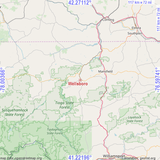
Wellsboro GPS coordinates[2]
41° 44' 55.248" North, 77° 18' 1.908" West
| Map corner | latitude | longitude |
|---|---|---|
| Upper-left | 42.27112°, | -78.00366° |
| Center: | 41.74868°, | -77.30053° |
| Lower-right: | 41.22196°, | -76.59741° |
| Map W x H: | 116.7×116.7 km | = 72.5×72.5mi |
| max Lat: | 71.29058° ⇑26.6% North |
| Wellsboro: | 41.74868° |
| min Lat: | ⇓73.4% South 19.06759° |
| min Long | Wellsboro | max Long |
| -171.73463° | -77.30053° | -66.98998° |
| W 79.5%⇐ | ⇒20.5% E |
Elevation
Elevation of Wellsboro is 401 m = 1316 ft, and this is 106.2 m = 348 ft above average elevation for this country.
| Max E: |
3189 m = 10463 ft | 16.2% |
| Wellsboro | 401 m 1316 ft | |
| Avg. | 294.8 m = 967 ft | |
Min E: |
-60 m = -197 ft | 83.8% |
See also: United States elevation on elevation.city.
Geographical zone
Wellsboro is located in North temperate zone (between Tropic of Cancer and the Arctic Circle). Distance of this Northern Tropic circle is 2036.1 km =1265.2 mi to South.| Distance of | km | miles | from Wellsboro |
|---|---|---|---|
| North Pole | 5365 | 3333.7 | to North |
| Arctic Circle | 2759.2 | 1714.5 | to North |
| Tropic Cancer | 2036.1 | 1265.2 | to South |
| Equator | 4642 | 2884.4 | to South |


Nearby cities:
15 places around Wellsboro: (largest is in red/bold)
• Addison
39.8 km =24.7 mi,  8°
8°
• Blossburg
21.1 km =13.1 mi,  111°
111°
• Canton
38.5 km =23.9 mi, 105°
• Elkland
26.4 km =16.4 mi,  358°
358°
• Galeton
28.4 km =17.6 mi,  266°
266°
• Gang Mills
46.9 km =29.1 mi,  19°
19°
• Knoxville
25.9 km =16.1 mi,  333°
333°
• Lawrenceville
31.2 km =19.4 mi,  27°
27°
• Lindley
33.8 km =21 mi, 23°
• Mansfield
19.6 km =12.2 mi,  70°
70°
• South Corning
46.9 km =29.1 mi, 27°
• Tioga
22.6 km =14 mi,  37°
37°
• Troy
42.7 km =26.5 mi,  84°
84°
• Ulysses
41.9 km =26 mi,  294°
294°
• Westfield
27.4 km =17 mi,  313°
313°
Sources, notices
• [Note1] Compared only with cities in United States existing in our database
• [Src1] Map data: © OpenStreetMap contributors (CC-BY-SA)
• [Src2] Other city data from geonames.org with taken over terms of usage.
• [Src3] Geographical zone / Annual Mean Temperature by Robert A. Rohde @ Wikipedia
