Lenkerville geodata
Lenkerville (Pennsylvania) is a populated place; located in United States in America/New_York (GMT-4) time zone. With population of 550 people, there are 20274 cities with bigger population in this country. Compared to other cities in United States, 59.2% of cities are located further ↓South; 80.7% of cities are located further ←West and 65.2% of cities have higher elevation than Lenkerville. Note1
Administrative division(s):
- Level 1: Pennsylvania
- Level 2: Dauphin County
- Level 3: Township of Upper Paxton


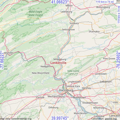
Lenkerville GPS coordinates[2]
40° 32' 2.292" North, 76° 57' 32.904" West
| Map corner | latitude | longitude |
|---|---|---|
| Upper-left | 41.06623°, | -77.66227° |
| Center: | 40.53397°, | -76.95914° |
| Lower-right: | 39.99745°, | -76.25602° |
| Map W x H: | 118.8×118.8 km | = 73.8×73.8mi |
| max Lat: | 71.29058° ⇑40.8% North |
| Lenkerville: | 40.53397° |
| min Lat: | ⇓59.2% South 19.06759° |
| min Long | Lenkerville | max Long |
| -171.73463° | -76.95914° | -66.98998° |
| W 80.7%⇐ | ⇒19.3% E |
Elevation
Elevation of Lenkerville is 127 m = 417 ft, and this is 167.8 m = 551 ft below average elevation for this country.
| Max E: |
3189 m = 10463 ft | 65.2% |
| Avg. | 294.8 m = 967 ft | |
| Lenkerville | 127 m = 417 ft | |
Min E: |
-60 m = -197 ft | 34.8% |
See also: United States elevation on elevation.city.
Geographical zone
Lenkerville is located in North temperate zone (between Tropic of Cancer and the Arctic Circle). Distance of this Northern Tropic circle is 1901 km =1181.2 mi to South.| Distance of | km | miles | from Lenkerville |
|---|---|---|---|
| North Pole | 5500.1 | 3417.6 | to North |
| Arctic Circle | 2894.2 | 1798.4 | to North |
| Tropic Cancer | 1901 | 1181.2 | to South |
| Equator | 4507 | 2800.5 | to South |


Nearby cities:
15 places around Lenkerville: (largest is in red/bold)
• Dauphin
18.7 km =11.6 mi,  172°
172°
• Duncannon
16 km =9.9 mi,  199°
199°
• Elizabethville
12.6 km =7.8 mi,  82°
82°
• Gratz
22.1 km =13.7 mi,  66°
66°
• Halifax
7.7 km =4.8 mi,  162°
162°
• Liverpool
5.2 km =3.2 mi,  330°
330°
• Lykens
22.2 km =13.8 mi, 80°
• Marysville
21.4 km =13.3 mi, 173°
• Matamoras
10.7 km =6.6 mi, 168°
• Millersburg
0.6 km =0.4 mi,  347°
347°
• Millerstown
16.6 km =10.3 mi,  275°
275°
• Newport
15.8 km =9.8 mi,  246°
246°
• Port Trevorton
20.8 km =12.9 mi,  22°
22°
• Richfield
21.5 km =13.4 mi,  322°
322°
• Wiconisco
23 km =14.3 mi, 79°
Sources, notices
• [Note1] Compared only with cities in United States existing in our database
• [Src1] Map data: © OpenStreetMap contributors (CC-BY-SA)
• [Src2] Other city data from geonames.org with taken over terms of usage.
• [Src3] Geographical zone / Annual Mean Temperature by Robert A. Rohde @ Wikipedia
