Elizabethville geodata
Elizabethville (Pennsylvania) is a populated place; located in United States in America/New_York (GMT-4) time zone. With population of 1,493 people, there are 13685 cities with bigger population in this country. Compared to other cities in United States, 59.4% of cities are located further ↓South; 81.4% of cities are located further ←West and 51.9% of cities have lower elevation than Elizabethville. Note1
Administrative division(s):
- Level 1: Pennsylvania
- Level 2: Dauphin County
- Level 3: Borough of Elizabethville


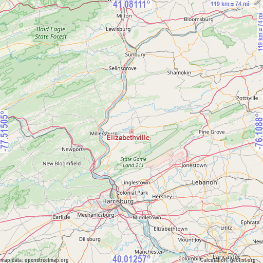
Elizabethville GPS coordinates[2]
40° 32' 56.292" North, 76° 48' 42.912" West
| Map corner | latitude | longitude |
|---|---|---|
| Upper-left | 41.08111°, | -77.51505° |
| Center: | 40.54897°, | -76.81192° |
| Lower-right: | 40.01257°, | -76.1088° |
| Map W x H: | 118.8×118.8 km | = 73.8×73.8mi |
| max Lat: | 71.29058° ⇑40.6% North |
| Elizabethville: | 40.54897° |
| min Lat: | ⇓59.4% South 19.06759° |
| min Long | Elizabethville | max Long |
| -171.73463° | -76.81192° | -66.98998° |
| W 81.4%⇐ | ⇒18.6% E |
Elevation
Elevation of Elizabethville is 206 m = 676 ft, and this is 88.8 m = 291 ft below average elevation for this country.
| Max E: |
3189 m = 10463 ft | 48.1% |
| Avg. | 294.8 m = 967 ft | |
| Elizabethville | 206 m = 676 ft | |
Min E: |
-60 m = -197 ft | 51.9% |
See also: United States elevation on elevation.city.
Geographical zone
Elizabethville is located in North temperate zone (between Tropic of Cancer and the Arctic Circle). Distance of this Northern Tropic circle is 1902.7 km =1182.3 mi to South.| Distance of | km | miles | from Elizabethville |
|---|---|---|---|
| North Pole | 5498.4 | 3416.5 | to North |
| Arctic Circle | 2892.6 | 1797.4 | to North |
| Tropic Cancer | 1902.7 | 1182.3 | to South |
| Equator | 4508.6 | 2801.5 | to South |


Nearby cities:
15 places around Elizabethville: (largest is in red/bold)
• Dauphin
22.6 km =14 mi,  206°
206°
• Gratz
10.5 km =6.5 mi,  48°
48°
• Halifax
13.6 km =8.5 mi,  228°
228°
• Lawrence Park
22.6 km =14 mi,  177°
177°
• Lenkerville
12.6 km =7.8 mi,  262°
262°
• Linglestown
24 km =14.9 mi, 175°
• Liverpool
15.2 km =9.4 mi,  280°
280°
• Lykens
9.6 km =6 mi,  78°
78°
• Matamoras
15.9 km =9.9 mi,  220°
220°
• Millersburg
12.6 km =7.8 mi,  265°
265°
• Port Trevorton
18.2 km =11.3 mi,  345°
345°
• Skyline View
24.4 km =15.2 mi,  162°
162°
• Tower City
22.4 km =13.9 mi, 78°
• Wiconisco
10.5 km =6.5 mi, 75°
• Williamstown
16.8 km =10.4 mi, 78°
Sources, notices
• [Note1] Compared only with cities in United States existing in our database
• [Src1] Map data: © OpenStreetMap contributors (CC-BY-SA)
• [Src2] Other city data from geonames.org with taken over terms of usage.
• [Src3] Geographical zone / Annual Mean Temperature by Robert A. Rohde @ Wikipedia
