Skippack geodata
Skippack (Pennsylvania) is a populated place; located in United States in America/New_York (GMT-4) time zone. With population of 3,758 people, there are 8515 cities with bigger population in this country. Compared to other cities in United States, 55.8% of cities are located further ↓South; 86% of cities are located further ←West and 76.7% of cities have higher elevation than Skippack. Note1
Administrative division(s):
- Level 1: Pennsylvania
- Level 2: Montgomery County
- Level 3: Township of Skippack


Skippack GPS coordinates[2]
40° 13' 22.368" North, 75° 23' 55.644" West
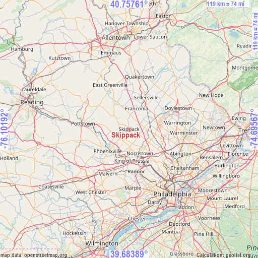
| Map corner | latitude | longitude |
|---|---|---|
| Upper-left | 40.75761°, | -76.10192° |
| Center: | 40.22288°, | -75.39879° |
| Lower-right: | 39.68389°, | -74.69567° |
| Map W x H: | 119.4×119.4 km | = 74.2×74.2mi |
| max Lat: | 71.29058° ⇑44.2% North |
| Skippack: | 40.22288° |
| min Lat: | ⇓55.8% South 19.06759° |
| min Long | Skippack | max Long |
| -171.73463° | -75.39879° | -66.98998° |
| W 86%⇐ | ⇒14% E |
Elevation
Elevation of Skippack is 62 m = 203 ft, and this is 232.8 m = 764 ft below average elevation for this country.
| Max E: |
3189 m = 10463 ft | 76.7% |
| Avg. | 294.8 m = 967 ft | |
| Skippack | 62 m = 203 ft | |
Min E: |
-60 m = -197 ft | 23.3% |
See also: United States elevation on elevation.city.
Geographical zone
Skippack is located in North temperate zone (between Tropic of Cancer and the Arctic Circle). Distance of this Northern Tropic circle is 1866.4 km =1159.7 mi to South.| Distance of | km | miles | from Skippack |
|---|---|---|---|
| North Pole | 5534.7 | 3439.1 | to North |
| Arctic Circle | 2928.8 | 1819.9 | to North |
| Tropic Cancer | 1866.4 | 1159.7 | to South |
| Equator | 4472.4 | 2779 | to South |


Nearby cities:
15 places around Skippack: (largest is in red/bold)
• Collegeville
6.1 km =3.8 mi,  227°
227°
• Eagleville
7.1 km =4.4 mi,  186°
186°
• Evansburg
5.3 km =3.3 mi,  208°
208°
• Harleysville
6.4 km =4 mi,  8°
8°
• Hatfield
10.6 km =6.6 mi,  53°
53°
• Kulpsville
5.7 km =3.5 mi,  67°
67°
• Lansdale
10 km =6.2 mi,  78°
78°
• Limerick
10.5 km =6.5 mi,  274°
274°
• North Wales
10.3 km =6.4 mi,  97°
97°
• Schwenksville
6.6 km =4.1 mi,  303°
303°
• Spring Mount
7.6 km =4.7 mi,  320°
320°
• Trappe
7.1 km =4.4 mi,  248°
248°
• Trooper
8.1 km =5 mi,  181°
181°
• West Norriton
10.5 km =6.5 mi,  170°
170°
• Woxall
10.6 km =6.6 mi,  336°
336°
Sources, notices
• [Note1] Compared only with cities in United States existing in our database
• [Src1] Map data: © OpenStreetMap contributors (CC-BY-SA)
• [Src2] Other city data from geonames.org with taken over terms of usage.
• [Src3] Geographical zone / Annual Mean Temperature by Robert A. Rohde @ Wikipedia
