Rockingham geodata
Rockingham (Vermont) is a populated place; located in United States in America/New_York (GMT-4) time zone. With population of 5,198 people, there are 7002 cities with bigger population in this country. Compared to other cities in United States, 84.8% of cities are located further ↓South; 94.9% of cities are located further ←West and 60.7% of cities have higher elevation than Rockingham. Note1


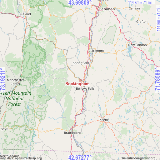
Rockingham GPS coordinates[2]
43° 11' 15.288" North, 72° 29' 20.328" West
| Map corner | latitude | longitude |
|---|---|---|
| Upper-left | 43.69809°, | -73.19211° |
| Center: | 43.18758°, | -72.48898° |
| Lower-right: | 42.67277°, | -71.78586° |
| Map W x H: | 114×114 km | = 70.8×70.8mi |
| max Lat: | 71.29058° ⇑15.2% North |
| Rockingham: | 43.18758° |
| min Lat: | ⇓84.8% South 19.06759° |
| min Long | Rockingham | max Long |
| -171.73463° | -72.48898° | -66.98998° |
| W 94.9%⇐ | ⇒5.1% E |
Elevation
Elevation of Rockingham is 151 m = 495 ft, and this is 143.8 m = 472 ft below average elevation for this country.
| Max E: |
3189 m = 10463 ft | 60.7% |
| Avg. | 294.8 m = 967 ft | |
| Rockingham | 151 m = 495 ft | |
Min E: |
-60 m = -197 ft | 39.3% |
See also: United States elevation on elevation.city.
Geographical zone
Rockingham is located in North temperate zone (between Tropic of Cancer and the Arctic Circle). Distance of this Northern Tropic circle is 2196.1 km =1364.6 mi to South.| Distance of | km | miles | from Rockingham |
|---|---|---|---|
| North Pole | 5205.1 | 3234.3 | to North |
| Arctic Circle | 2599.2 | 1615.1 | to North |
| Tropic Cancer | 2196.1 | 1364.6 | to South |
| Equator | 4802 | 2983.8 | to South |


Nearby cities:
15 places around Rockingham: (largest is in red/bold)
• Acworth
16.3 km =10.1 mi,  78°
78°
• Alstead
11.3 km =7 mi,  112°
112°
• Bellows Falls
7 km =4.3 mi,  148°
148°
• Charlestown
7.7 km =4.8 mi,  42°
42°
• Chester
12 km =7.5 mi,  314°
314°
• Langdon
9.2 km =5.7 mi,  104°
104°
• Lempster
23.3 km =14.5 mi, 75°
• North Springfield
16.4 km =10.2 mi,  349°
349°
• North Walpole
6.3 km =3.9 mi, 148°
• Saxtons River
5.8 km =3.6 mi,  196°
196°
• Springfield
12.3 km =7.6 mi,  2°
2°
• Surry
23.3 km =14.5 mi,  144°
144°
• Townshend
21.3 km =13.2 mi,  222°
222°
• Unity
22 km =13.7 mi,  57°
57°
• Walpole
13.1 km =8.1 mi,  156°
156°
Sources, notices
• [Note1] Compared only with cities in United States existing in our database
• [Src1] Map data: © OpenStreetMap contributors (CC-BY-SA)
• [Src2] Other city data from geonames.org with taken over terms of usage.
• [Src3] Geographical zone / Annual Mean Temperature by Robert A. Rohde @ Wikipedia
