Cuba City geodata
Cuba City (Wisconsin) is a populated place; located in United States in America/Chicago (GMT-5) time zone. With population of 2,055 people, there are 11770 cities with bigger population in this country. Compared to other cities in United States, 80.6% of cities are located further ↓South; 60.6% of cities are located further →East and 74.4% of cities have lower elevation than Cuba City. Note1


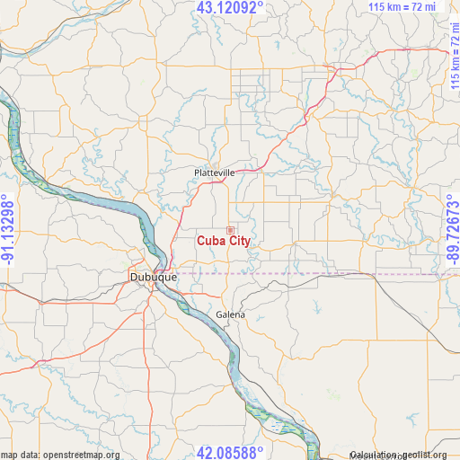
Cuba City GPS coordinates[2]
42° 36' 19.98" North, 90° 25' 47.46" West
| Map corner | latitude | longitude |
|---|---|---|
| Upper-left | 43.12092°, | -91.13298° |
| Center: | 42.60555°, | -90.42985° |
| Lower-right: | 42.08588°, | -89.72673° |
| Map W x H: | 115.1×115.1 km | = 71.5×71.5mi |
| max Lat: | 71.29058° ⇑19.4% North |
| Cuba City: | 42.60555° |
| min Lat: | ⇓80.6% South 19.06759° |
| min Long | Cuba City | max Long |
| -171.73463° | -90.42985° | -66.98998° |
| W 39.4%⇐ | ⇒60.6% E |
Elevation
Elevation of Cuba City is 309 m = 1014 ft, and this is 14.2 m = 47 ft above average elevation for this country.
| Max E: |
3189 m = 10463 ft | 25.6% |
| Cuba City | 309 m 1014 ft | |
| Avg. | 294.8 m = 967 ft | |
Min E: |
-60 m = -197 ft | 74.4% |
See also: United States elevation on elevation.city.
Geographical zone
Cuba City is located in North temperate zone (between Tropic of Cancer and the Arctic Circle). Distance of this Northern Tropic circle is 2131.4 km =1324.4 mi to South.| Distance of | km | miles | from Cuba City |
|---|---|---|---|
| North Pole | 5269.8 | 3274.5 | to North |
| Arctic Circle | 2663.9 | 1655.3 | to North |
| Tropic Cancer | 2131.4 | 1324.4 | to South |
| Equator | 4737.3 | 2943.6 | to South |


Nearby cities:
15 places around Cuba City: (largest is in red/bold)
• Apple Canyon Lake
30.4 km =18.9 mi,  132°
132°
• Asbury
28.2 km =17.5 mi,  248°
248°
• Belmont
16.5 km =10.3 mi,  28°
28°
• Benton
5.7 km =3.5 mi, 134°
• Darlington
27 km =16.8 mi,  71°
71°
• Dickeyville
13.5 km =8.4 mi,  280°
280°
• Dubuque
22.5 km =14 mi,  238°
238°
• East Dubuque
21.5 km =13.4 mi,  234°
234°
• Galena
21 km =13 mi,  179°
179°
• Hazel Green
8.1 km =5 mi, 182°
• Livingston
32.7 km =20.3 mi,  359°
359°
• Platteville
14.8 km =9.2 mi,  344°
344°
• Potosi
24.9 km =15.5 mi,  292°
292°
• Shullsburg
16.7 km =10.4 mi,  102°
102°
• The Galena Territory
25.1 km =15.6 mi,  160°
160°
Sources, notices
• [Note1] Compared only with cities in United States existing in our database
• [Src1] Map data: © OpenStreetMap contributors (CC-BY-SA)
• [Src2] Other city data from geonames.org with taken over terms of usage.
• [Src3] Geographical zone / Annual Mean Temperature by Robert A. Rohde @ Wikipedia
