Glenmore geodata
Glenmore (Wisconsin) is a populated place; located in United States in America/Chicago (GMT-5) time zone. With population of 1,142 people, there are 15428 cities with bigger population in this country. Compared to other cities in United States, 90% of cities are located further ↓South; 52.5% of cities are located further →East and 68.9% of cities have lower elevation than Glenmore. Note1


Glenmore GPS coordinates[2]
44° 23' 8.988" North, 87° 55' 38.352" West
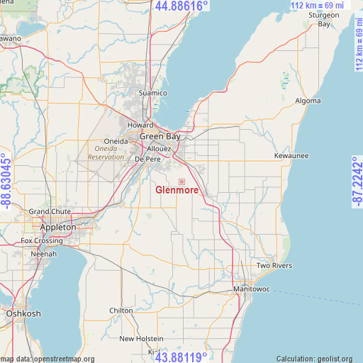
| Map corner | latitude | longitude |
|---|---|---|
| Upper-left | 44.88616°, | -88.63045° |
| Center: | 44.38583°, | -87.92732° |
| Lower-right: | 43.88119°, | -87.2242° |
| Map W x H: | 111.7×111.7 km | = 69.4×69.4mi |
| max Lat: | 71.29058° ⇑10% North |
| Glenmore: | 44.38583° |
| min Lat: | ⇓90% South 19.06759° |
| min Long | Glenmore | max Long |
| -171.73463° | -87.92732° | -66.98998° |
| W 47.5%⇐ | ⇒52.5% E |
Elevation
Elevation of Glenmore is 280 m = 919 ft, and this is 14.8 m = 49 ft below average elevation for this country.
| Max E: |
3189 m = 10463 ft | 31.1% |
| Avg. | 294.8 m = 967 ft | |
| Glenmore | 280 m = 919 ft | |
Min E: |
-60 m = -197 ft | 68.9% |
See also: United States elevation on elevation.city.
Geographical zone
Glenmore is located in North temperate zone (between Tropic of Cancer and the Arctic Circle). Distance of this Northern Tropic circle is 2329.3 km =1447.4 mi to South.| Distance of | km | miles | from Glenmore |
|---|---|---|---|
| North Pole | 5071.8 | 3151.5 | to North |
| Arctic Circle | 2465.9 | 1532.2 | to North |
| Tropic Cancer | 2329.3 | 1447.4 | to South |
| Equator | 4935.2 | 3066.6 | to South |


Nearby cities:
15 places around Glenmore: (largest is in red/bold)
• Allouez
12.4 km =7.7 mi,  325°
325°
• Ashwaubenon
15.6 km =9.7 mi,  313°
313°
• Bellevue
6.5 km =4 mi,  5°
5°
• Brillion
25.6 km =15.9 mi,  205°
205°
• Cooperstown
14.6 km =9.1 mi,  123°
123°
• De Pere
12.7 km =7.9 mi,  303°
303°
• Denmark
9 km =5.6 mi, 118°
• Green Bay
16.5 km =10.3 mi, 333°
• Greenleaf
15.7 km =9.8 mi,  239°
239°
• Hobart
21.7 km =13.5 mi, 305°
• Howard
21.7 km =13.5 mi,  323°
323°
• Luxemburg
24.6 km =15.3 mi,  46°
46°
• Maple Grove
21.8 km =13.5 mi,  179°
179°
• Oneida
23.8 km =14.8 mi, 301°
• Wrightstown
19.9 km =12.4 mi,  250°
250°
Sources, notices
• [Note1] Compared only with cities in United States existing in our database
• [Src1] Map data: © OpenStreetMap contributors (CC-BY-SA)
• [Src2] Other city data from geonames.org with taken over terms of usage.
• [Src3] Geographical zone / Annual Mean Temperature by Robert A. Rohde @ Wikipedia
