Greenleaf geodata
Greenleaf (Wisconsin) is a populated place; located in United States in America/Chicago (GMT-5) time zone. With population of 607 people, there are 19621 cities with bigger population in this country. Compared to other cities in United States, 89.7% of cities are located further ↓South; 53.3% of cities are located further →East and 55.1% of cities have lower elevation than Greenleaf. Note1


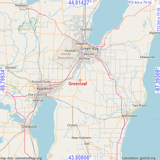
Greenleaf GPS coordinates[2]
44° 18' 47.952" North, 88° 5' 46.356" West
| Map corner | latitude | longitude |
|---|---|---|
| Upper-left | 44.81427°, | -88.79934° |
| Center: | 44.31332°, | -88.09621° |
| Lower-right: | 43.80806°, | -87.39309° |
| Map W x H: | 111.9×111.9 km | = 69.5×69.5mi |
| max Lat: | 71.29058° ⇑10.3% North |
| Greenleaf: | 44.31332° |
| min Lat: | ⇓89.7% South 19.06759° |
| min Long | Greenleaf | max Long |
| -171.73463° | -88.09621° | -66.98998° |
| W 46.7%⇐ | ⇒53.3% E |
Elevation
Elevation of Greenleaf is 219 m = 719 ft, and this is 75.8 m = 249 ft below average elevation for this country.
| Max E: |
3189 m = 10463 ft | 44.9% |
| Avg. | 294.8 m = 967 ft | |
| Greenleaf | 219 m = 719 ft | |
Min E: |
-60 m = -197 ft | 55.1% |
See also: United States elevation on elevation.city.
Geographical zone
Greenleaf is located in North temperate zone (between Tropic of Cancer and the Arctic Circle). Distance of this Northern Tropic circle is 2321.3 km =1442.4 mi to South.| Distance of | km | miles | from Greenleaf |
|---|---|---|---|
| North Pole | 5079.9 | 3156.5 | to North |
| Arctic Circle | 2474 | 1537.3 | to North |
| Tropic Cancer | 2321.3 | 1442.4 | to South |
| Equator | 4927.2 | 3061.6 | to South |


Nearby cities:
15 places around Greenleaf: (largest is in red/bold)
• Allouez
19.3 km =12 mi,  19°
19°
• Ashwaubenon
18.9 km =11.7 mi,  6°
6°
• Bellevue
20.2 km =12.6 mi,  43°
43°
• Brillion
15.3 km =9.5 mi,  170°
170°
• Combined Locks
18.1 km =11.2 mi,  253°
253°
• De Pere
15.3 km =9.5 mi, 10°
• Forest Junction
11.8 km =7.3 mi,  198°
198°
• Glenmore
15.7 km =9.8 mi,  59°
59°
• Hilbert
20 km =12.4 mi, 195°
• Kaukauna
14.5 km =9 mi, 254°
• Kimberly
19.9 km =12.4 mi,  256°
256°
• Little Chute
18.1 km =11.2 mi, 258°
• Maple Grove
19.5 km =12.1 mi,  135°
135°
• Sherwood
20.3 km =12.6 mi,  219°
219°
• Wrightstown
5.5 km =3.4 mi,  284°
284°
Sources, notices
• [Note1] Compared only with cities in United States existing in our database
• [Src1] Map data: © OpenStreetMap contributors (CC-BY-SA)
• [Src2] Other city data from geonames.org with taken over terms of usage.
• [Src3] Geographical zone / Annual Mean Temperature by Robert A. Rohde @ Wikipedia
