Hortonville geodata
Hortonville (Wisconsin) is a populated place; located in United States in America/Chicago (GMT-5) time zone. With population of 2,712 people, there are 10154 cities with bigger population in this country. Compared to other cities in United States, 89.8% of cities are located further ↓South; 55.2% of cities are located further →East and 61.2% of cities have lower elevation than Hortonville. Note1
Administrative division(s):
- Level 1: Wisconsin
- Level 2: Outagamie County
- Level 3: Village of Hortonville


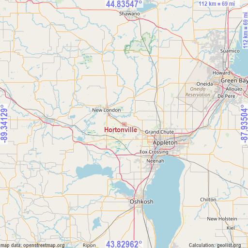
Hortonville GPS coordinates[2]
44° 20' 4.92" North, 88° 38' 17.376" West
| Map corner | latitude | longitude |
|---|---|---|
| Upper-left | 44.83547°, | -89.34129° |
| Center: | 44.3347°, | -88.63816° |
| Lower-right: | 43.82962°, | -87.93504° |
| Map W x H: | 111.8×111.8 km | = 69.5×69.5mi |
| max Lat: | 71.29058° ⇑10.2% North |
| Hortonville: | 44.3347° |
| min Lat: | ⇓89.8% South 19.06759° |
| min Long | Hortonville | max Long |
| -171.73463° | -88.63816° | -66.98998° |
| W 44.8%⇐ | ⇒55.2% E |
Elevation
Elevation of Hortonville is 245 m = 804 ft, and this is 49.8 m = 163 ft below average elevation for this country.
| Max E: |
3189 m = 10463 ft | 38.8% |
| Avg. | 294.8 m = 967 ft | |
| Hortonville | 245 m = 804 ft | |
Min E: |
-60 m = -197 ft | 61.2% |
See also: United States elevation on elevation.city.
Geographical zone
Hortonville is located in North temperate zone (between Tropic of Cancer and the Arctic Circle). Distance of this Northern Tropic circle is 2323.6 km =1443.8 mi to South.| Distance of | km | miles | from Hortonville |
|---|---|---|---|
| North Pole | 5077.5 | 3155 | to North |
| Arctic Circle | 2471.6 | 1535.8 | to North |
| Tropic Cancer | 2323.6 | 1443.8 | to South |
| Equator | 4929.6 | 3063.1 | to South |


Nearby cities:
15 places around Hortonville: (largest is in red/bold)
• Appleton
19.5 km =12.1 mi,  114°
114°
• Black Creek
21.8 km =13.5 mi,  43°
43°
• Butte des Morts
26.2 km =16.3 mi,  182°
182°
• Dale
7.6 km =4.7 mi,  205°
205°
• Fremont
19.9 km =12.4 mi,  245°
245°
• Kimberly
24.8 km =15.4 mi, 106°
• Little Chute
26.2 km =16.3 mi,  103°
103°
• Manawa
26.6 km =16.5 mi,  302°
302°
• Menasha
21.2 km =13.2 mi,  133°
133°
• Neenah
21.7 km =13.5 mi,  139°
139°
• New London
10.3 km =6.4 mi,  308°
308°
• Shiocton
13.1 km =8.1 mi,  21°
21°
• Weyauwega
23.6 km =14.7 mi,  266°
266°
• Winchester
15.3 km =9.5 mi,  187°
187°
• Winneconne
25.6 km =15.9 mi, 193°
Sources, notices
• [Note1] Compared only with cities in United States existing in our database
• [Src1] Map data: © OpenStreetMap contributors (CC-BY-SA)
• [Src2] Other city data from geonames.org with taken over terms of usage.
• [Src3] Geographical zone / Annual Mean Temperature by Robert A. Rohde @ Wikipedia
