Appleton geodata
Appleton (Wisconsin) is a seat of a second-order administrative division; located in United States in America/Chicago (GMT-5) time zone. With population of 74,139 people, there are 551 cities with bigger population in this country. Compared to other cities in United States, 89.5% of cities are located further ↓South; 54.5% of cities are located further →East and 60.7% of cities have lower elevation than Appleton. Note1


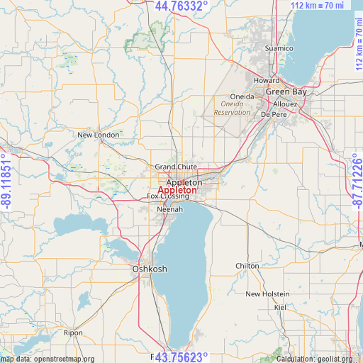
Appleton GPS coordinates[2]
44° 15' 42.948" North, 88° 24' 55.368" West
| Map corner | latitude | longitude |
|---|---|---|
| Upper-left | 44.76332°, | -89.11851° |
| Center: | 44.26193°, | -88.41538° |
| Lower-right: | 43.75623°, | -87.71226° |
| Map W x H: | 112×112 km | = 69.6×69.6mi |
| max Lat: | 71.29058° ⇑10.5% North |
| Appleton: | 44.26193° |
| min Lat: | ⇓89.5% South 19.06759° |
| min Long | Appleton | max Long |
| -171.73463° | -88.41538° | -66.98998° |
| W 45.5%⇐ | ⇒54.5% E |
Elevation
Elevation of Appleton is 243 m = 797 ft, and this is 51.8 m = 170 ft below average elevation for this country.
| Max E: |
3189 m = 10463 ft | 39.3% |
| Avg. | 294.8 m = 967 ft | |
| Appleton | 243 m = 797 ft | |
Min E: |
-60 m = -197 ft | 60.7% |
See also: Appleton elevation on elevation.city.
Geographical zone
Appleton is located in North temperate zone (between Tropic of Cancer and the Arctic Circle). Distance of this Northern Tropic circle is 2315.5 km =1438.8 mi to South.| Distance of | km | miles | from Appleton |
|---|---|---|---|
| North Pole | 5085.6 | 3160 | to North |
| Arctic Circle | 2479.7 | 1540.8 | to North |
| Tropic Cancer | 2315.5 | 1438.8 | to South |
| Equator | 4921.5 | 3058.1 | to South |


Nearby cities:
15 places around Appleton: (largest is in red/bold)
• Combined Locks
8.1 km =5 mi,  86°
86°
• Dale
21 km =13 mi,  273°
273°
• Forest Junction
22.3 km =13.9 mi,  104°
104°
• Harrison
7.4 km =4.6 mi,  120°
120°
• Hortonville
19.5 km =12.1 mi,  294°
294°
• Kaukauna
11.6 km =7.2 mi,  81°
81°
• Kimberly
6.2 km =3.9 mi, 79°
• Little Chute
8 km =5 mi, 75°
• Menasha
7.1 km =4.4 mi,  200°
200°
• Neenah
9.3 km =5.8 mi, 203°
• Sherwood
15.8 km =9.8 mi,  128°
128°
• Shiocton
24.1 km =15 mi,  327°
327°
• Stockbridge
23.1 km =14.4 mi,  156°
156°
• Winchester
21.1 km =13.1 mi,  250°
250°
• Wrightstown
21.3 km =13.2 mi,  70°
70°
Sources, notices
• [Note1] Compared only with cities in United States existing in our database
• [Src1] Map data: © OpenStreetMap contributors (CC-BY-SA)
• [Src2] Other city data from geonames.org with taken over terms of usage.
• [Src3] Geographical zone / Annual Mean Temperature by Robert A. Rohde @ Wikipedia
