Whitelaw geodata
Whitelaw (Wisconsin) is a populated place; located in United States in America/Chicago (GMT-5) time zone. With population of 744 people, there are 18268 cities with bigger population in this country. Compared to other cities in United States, 89% of cities are located further ↓South; 52% of cities are located further →East and 65.2% of cities have lower elevation than Whitelaw. Note1
Administrative division(s):
- Level 1: Wisconsin
- Level 2: Manitowoc County
- Level 3: Village of Whitelaw


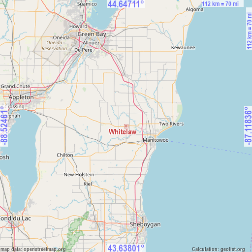
Whitelaw GPS coordinates[2]
44° 8' 40.992" North, 87° 49' 17.328" West
| Map corner | latitude | longitude |
|---|---|---|
| Upper-left | 44.64711°, | -88.52461° |
| Center: | 44.14472°, | -87.82148° |
| Lower-right: | 43.63801°, | -87.11836° |
| Map W x H: | 112.2×112.2 km | = 69.7×69.7mi |
| max Lat: | 71.29058° ⇑11% North |
| Whitelaw: | 44.14472° |
| min Lat: | ⇓89% South 19.06759° |
| min Long | Whitelaw | max Long |
| -171.73463° | -87.82148° | -66.98998° |
| W 48%⇐ | ⇒52% E |
Elevation
Elevation of Whitelaw is 263 m = 863 ft, and this is 31.8 m = 104 ft below average elevation for this country.
| Max E: |
3189 m = 10463 ft | 34.8% |
| Avg. | 294.8 m = 967 ft | |
| Whitelaw | 263 m = 863 ft | |
Min E: |
-60 m = -197 ft | 65.2% |
See also: United States elevation on elevation.city.
Geographical zone
Whitelaw is located in North temperate zone (between Tropic of Cancer and the Arctic Circle). Distance of this Northern Tropic circle is 2302.5 km =1430.7 mi to South.| Distance of | km | miles | from Whitelaw |
|---|---|---|---|
| North Pole | 5098.6 | 3168.1 | to North |
| Arctic Circle | 2492.7 | 1548.9 | to North |
| Tropic Cancer | 2302.5 | 1430.7 | to South |
| Equator | 4908.4 | 3049.9 | to South |


Nearby cities:
15 places around Whitelaw: (largest is in red/bold)
• Brillion
19.7 km =12.2 mi,  280°
280°
• Cato
3.2 km =2 mi,  266°
266°
• Cleveland
26.2 km =16.3 mi,  166°
166°
• Cooperstown
19.1 km =11.9 mi,  11°
11°
• Denmark
22.6 km =14 mi,  358°
358°
• Forest Junction
26.8 km =16.7 mi,  286°
286°
• Francis Creek
10 km =6.2 mi,  52°
52°
• Hilbert
27.3 km =17 mi, 268°
• Manitowoc
14.5 km =9 mi,  115°
115°
• Maple Grove
9.6 km =6 mi,  301°
301°
• Mishicot
17.8 km =11.1 mi, 53°
• Reedsville
10.8 km =6.7 mi, 275°
• Saint Nazianz
17.2 km =10.7 mi,  207°
207°
• Two Rivers
20.1 km =12.5 mi,  87°
87°
• Valders
10.1 km =6.3 mi, 209°
Sources, notices
• [Note1] Compared only with cities in United States existing in our database
• [Src1] Map data: © OpenStreetMap contributors (CC-BY-SA)
• [Src2] Other city data from geonames.org with taken over terms of usage.
• [Src3] Geographical zone / Annual Mean Temperature by Robert A. Rohde @ Wikipedia
