Canton Valley geodata
Canton Valley (Connecticut) is a populated place; located in United States in America/New_York (GMT-4) time zone. With population of 1,580 people, there are 13353 cities with bigger population in this country. Compared to other cities in United States, 74.2% of cities are located further ↓South; 94.1% of cities are located further ←West and 52.8% of cities have lower elevation than Canton Valley. Note1


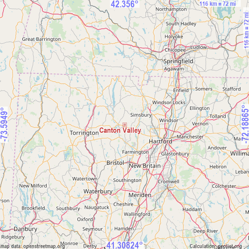
Canton Valley GPS coordinates[2]
41° 50' 3.336" North, 72° 53' 30.372" West
| Map corner | latitude | longitude |
|---|---|---|
| Upper-left | 42.356°, | -73.5949° |
| Center: | 41.83426°, | -72.89177° |
| Lower-right: | 41.30824°, | -72.18865° |
| Map W x H: | 116.5×116.5 km | = 72.4×72.4mi |
| max Lat: | 71.29058° ⇑25.8% North |
| Canton Valley: | 41.83426° |
| min Lat: | ⇓74.2% South 19.06759° |
| min Long | Canton Valley | max Long |
| -171.73463° | -72.89177° | -66.98998° |
| W 94.1%⇐ | ⇒5.9% E |
Elevation
Elevation of Canton Valley is 209 m = 686 ft, and this is 85.8 m = 281 ft below average elevation for this country.
| Max E: |
3189 m = 10463 ft | 47.2% |
| Avg. | 294.8 m = 967 ft | |
| Canton Valley | 209 m = 686 ft | |
Min E: |
-60 m = -197 ft | 52.8% |
See also: United States elevation on elevation.city.
Geographical zone
Canton Valley is located in North temperate zone (between Tropic of Cancer and the Arctic Circle). Distance of this Northern Tropic circle is 2045.6 km =1271.1 mi to South.| Distance of | km | miles | from Canton Valley |
|---|---|---|---|
| North Pole | 5355.5 | 3327.8 | to North |
| Arctic Circle | 2749.6 | 1708.5 | to North |
| Tropic Cancer | 2045.6 | 1271.1 | to South |
| Equator | 4651.5 | 2890.3 | to South |


Nearby cities:
15 places around Canton Valley: (largest is in red/bold)
• Blue Hills
16.3 km =10.1 mi,  98°
98°
• Bristol
18.7 km =11.6 mi,  194°
194°
• Collinsville
3.3 km =2.1 mi,  224°
224°
• Farmington
13.7 km =8.5 mi,  158°
158°
• New Hartford Center
8.6 km =5.3 mi,  306°
306°
• North Granby
18.7 km =11.6 mi,  15°
15°
• Northwest Harwinton
16.8 km =10.4 mi,  247°
247°
• Plainville
18 km =11.2 mi,  171°
171°
• Salmon Brook
15.8 km =9.8 mi,  30°
30°
• Simsbury Center
8.5 km =5.3 mi,  52°
52°
• Tariffville
13.7 km =8.5 mi, 52°
• Weatogue
5.4 km =3.4 mi,  78°
78°
• West Hartford
14.8 km =9.2 mi,  122°
122°
• West Simsbury
5.1 km =3.2 mi, 32°
• Winsted
17 km =10.6 mi,  304°
304°
Sources, notices
• [Note1] Compared only with cities in United States existing in our database
• [Src1] Map data: © OpenStreetMap contributors (CC-BY-SA)
• [Src2] Other city data from geonames.org with taken over terms of usage.
• [Src3] Geographical zone / Annual Mean Temperature by Robert A. Rohde @ Wikipedia
