Lompoc geodata
Lompoc (California) is a populated place; located in United States in America/Los_Angeles (GMT-7) time zone. With population of 44,164 people, there are 1080 cities with bigger population in this country. Compared to other cities in United States, 77.1% of cities are located further ↑North; 93.2% of cities are located further →East and 83.2% of cities have higher elevation than Lompoc. Note1


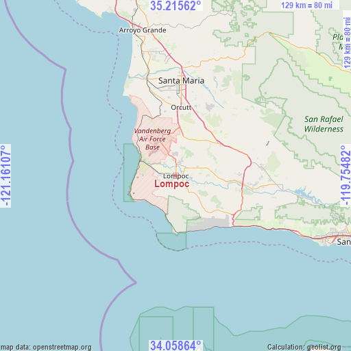
Lompoc GPS coordinates[2]
34° 38' 20.94" North, 120° 27' 28.584" West
| Map corner | latitude | longitude |
|---|---|---|
| Upper-left | 35.21562°, | -121.16107° |
| Center: | 34.63915°, | -120.45794° |
| Lower-right: | 34.05864°, | -119.75482° |
| Map W x H: | 128.6×128.6 km | = 79.9×79.9mi |
| max Lat: | 71.29058° ⇑77.1% North |
| Lompoc: | 34.63915° |
| min Lat: | ⇓22.9% South 19.06759° |
| min Long | Lompoc | max Long |
| -171.73463° | -120.45794° | -66.98998° |
| W 6.8%⇐ | ⇒93.2% E |
Elevation
Elevation of Lompoc is 34 m = 112 ft, and this is 260.8 m = 856 ft below average elevation for this country.
| Max E: |
3189 m = 10463 ft | 83.2% |
| Avg. | 294.8 m = 967 ft | |
| Lompoc | 34 m = 112 ft | |
Min E: |
-60 m = -197 ft | 16.8% |
See also: Lompoc elevation on elevation.city.
Geographical zone
Lompoc is located in North temperate zone (between Tropic of Cancer and the Arctic Circle). Distance of this Northern Tropic circle is 1245.6 km =774 mi to South.| Distance of | km | miles | from Lompoc |
|---|---|---|---|
| North Pole | 6155.5 | 3824.8 | to North |
| Arctic Circle | 3549.7 | 2205.7 | to North |
| Tropic Cancer | 1245.6 | 774 | to South |
| Equator | 3851.5 | 2393.2 | to South |


Nearby cities:
15 places around Lompoc: (largest is in red/bold)
• Blacklake
46.2 km =28.7 mi,  350°
350°
• Buellton
24.4 km =15.2 mi,  96°
96°
• Callender
47.7 km =29.6 mi,  344°
344°
• Guadalupe
38.4 km =23.9 mi, 344°
• Los Alamos
20.2 km =12.6 mi,  54°
54°
• Los Olivos
31.5 km =19.6 mi,  84°
84°
• Mission Hills
5.6 km =3.5 mi,  20°
20°
• Nipomo
44.9 km =27.9 mi,  357°
357°
• Orcutt
25.2 km =15.7 mi,  4°
4°
• Santa Maria
35 km =21.7 mi, 3°
• Santa Ynez
34.7 km =21.6 mi,  94°
94°
• Solvang
29.7 km =18.5 mi, 99°
• Vandenberg Air Force Base
13.3 km =8.3 mi, 335°
• Vandenberg Village
7.7 km =4.8 mi, 353°
• Woodlands
44.2 km =27.5 mi, 348°
Sources, notices
• [Note1] Compared only with cities in United States existing in our database
• [Src1] Map data: © OpenStreetMap contributors (CC-BY-SA)
• [Src2] Other city data from geonames.org with taken over terms of usage.
• [Src3] Geographical zone / Annual Mean Temperature by Robert A. Rohde @ Wikipedia
