Mi-Wuk Village geodata
Mi-Wuk Village (California) is a populated place; located in United States in America/Los_Angeles (GMT-7) time zone. With population of 941 people, there are 16706 cities with bigger population in this country. Compared to other cities in United States, 61.2% of cities are located further ↑North; 93% of cities are located further →East and 96.2% of cities have lower elevation than Mi-Wuk Village. Note1


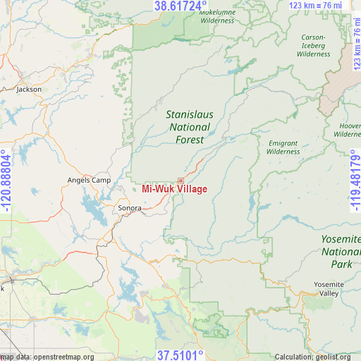
Mi-Wuk Village GPS coordinates[2]
38° 3' 56.736" North, 120° 11' 5.676" West
| Map corner | latitude | longitude |
|---|---|---|
| Upper-left | 38.61724°, | -120.88804° |
| Center: | 38.06576°, | -120.18491° |
| Lower-right: | 37.5101°, | -119.48179° |
| Map W x H: | 123.1×123.1 km | = 76.5×76.5mi |
| max Lat: | 71.29058° ⇑61.2% North |
| Mi-Wuk Village: | 38.06576° |
| min Lat: | ⇓38.8% South 19.06759° |
| min Long | Mi-Wuk Village | max Long |
| -171.73463° | -120.18491° | -66.98998° |
| W 7%⇐ | ⇒93% E |
Elevation
Elevation of Mi-Wuk Village is 1431 m = 4695 ft, and this is 1136.2 m = 3728 ft above average elevation for this country.
| Max E: |
3189 m = 10463 ft | 3.8% |
| Mi-Wuk Village | 1431 m 4695 ft | |
| Avg. | 294.8 m = 967 ft | |
Min E: |
-60 m = -197 ft | 96.2% |
See also: United States elevation on elevation.city.
Geographical zone
Mi-Wuk Village is located in North temperate zone (between Tropic of Cancer and the Arctic Circle). Distance of this Northern Tropic circle is 1626.6 km =1010.7 mi to South.| Distance of | km | miles | from Mi-Wuk Village |
|---|---|---|---|
| North Pole | 5774.5 | 3588.1 | to North |
| Arctic Circle | 3168.7 | 1968.9 | to North |
| Tropic Cancer | 1626.6 | 1010.7 | to South |
| Equator | 4232.5 | 2630 | to South |


Nearby cities:
15 places around Mi-Wuk Village: (largest is in red/bold)
• Avery
22.3 km =13.9 mi,  313°
313°
• Cedar Ridge
8 km =5 mi,  270°
270°
• Columbia
19.2 km =11.9 mi,  260°
260°
• East Sonora
18.3 km =11.4 mi,  237°
237°
• Forest Meadows
22.5 km =14 mi,  300°
300°
• Groveland
25.6 km =15.9 mi,  189°
189°
• Jamestown
24.3 km =15.1 mi, 239°
• Mono Vista
10.6 km =6.6 mi,  224°
224°
• Murphys
25.4 km =15.8 mi,  288°
288°
• Phoenix Lake
12.6 km =7.8 mi, 238°
• Sonora
19.5 km =12.1 mi, 242°
• Soulsbyville
11.4 km =7.1 mi, 217°
• Tuolumne City
12.5 km =7.8 mi,  203°
203°
• Tuttletown
25.4 km =15.8 mi,  251°
251°
• Twain Harte
5.1 km =3.2 mi, 235°
Sources, notices
• [Note1] Compared only with cities in United States existing in our database
• [Src1] Map data: © OpenStreetMap contributors (CC-BY-SA)
• [Src2] Other city data from geonames.org with taken over terms of usage.
• [Src3] Geographical zone / Annual Mean Temperature by Robert A. Rohde @ Wikipedia
