South Dos Palos geodata
South Dos Palos (California) is a populated place; located in United States in America/Los_Angeles (GMT-7) time zone. With population of 1,620 people, there are 13223 cities with bigger population in this country. Compared to other cities in United States, 66.3% of cities are located further ↑North; 93.5% of cities are located further →East and 83.6% of cities have higher elevation than South Dos Palos. Note1


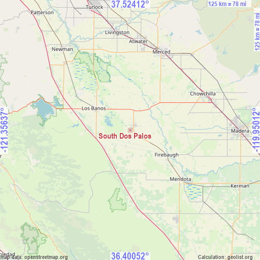
South Dos Palos GPS coordinates[2]
36° 57' 51.804" North, 120° 39' 11.664" West
| Map corner | latitude | longitude |
|---|---|---|
| Upper-left | 37.52412°, | -121.35637° |
| Center: | 36.96439°, | -120.65324° |
| Lower-right: | 36.40052°, | -119.95012° |
| Map W x H: | 124.9×124.9 km | = 77.6×77.6mi |
| max Lat: | 71.29058° ⇑66.3% North |
| South Dos Palos: | 36.96439° |
| min Lat: | ⇓33.7% South 19.06759° |
| min Long | South Dos Palos | max Long |
| -171.73463° | -120.65324° | -66.98998° |
| W 6.5%⇐ | ⇒93.5% E |
Elevation
Elevation of South Dos Palos is 33 m = 108 ft, and this is 261.8 m = 859 ft below average elevation for this country.
| Max E: |
3189 m = 10463 ft | 83.6% |
| Avg. | 294.8 m = 967 ft | |
| South Dos Palos | 33 m = 108 ft | |
Min E: |
-60 m = -197 ft | 16.4% |
See also: United States elevation on elevation.city.
Geographical zone
South Dos Palos is located in North temperate zone (between Tropic of Cancer and the Arctic Circle). Distance of this Northern Tropic circle is 1504.1 km =934.6 mi to South.| Distance of | km | miles | from South Dos Palos |
|---|---|---|---|
| North Pole | 5897 | 3664.2 | to North |
| Arctic Circle | 3291.1 | 2045 | to North |
| Tropic Cancer | 1504.1 | 934.6 | to South |
| Equator | 4110.1 | 2553.9 | to South |


Nearby cities:
15 places around South Dos Palos: (largest is in red/bold)
• Atwater
42.8 km =26.6 mi,  5°
5°
• Chowchilla
39.1 km =24.3 mi,  63°
63°
• Dos Palos
3.4 km =2.1 mi,  44°
44°
• Fairmead
42.7 km =26.5 mi,  73°
73°
• Firebaugh
21.1 km =13.1 mi,  123°
123°
• Gustine
44.8 km =27.8 mi,  316°
316°
• Le Grand
46.4 km =28.8 mi,  50°
50°
• Livingston
47.4 km =29.5 mi,  352°
352°
• Los Banos
20.3 km =12.6 mi,  300°
300°
• Mendota
33.7 km =20.9 mi,  134°
134°
• Merced
40.5 km =25.2 mi,  21°
21°
• Newman
50.7 km =31.5 mi, 320°
• Planada
46.9 km =29.1 mi, 39°
• Tranquillity
50 km =31.1 mi, 134°
• Winton
47.4 km =29.5 mi,  4°
4°
Sources, notices
• [Note1] Compared only with cities in United States existing in our database
• [Src1] Map data: © OpenStreetMap contributors (CC-BY-SA)
• [Src2] Other city data from geonames.org with taken over terms of usage.
• [Src3] Geographical zone / Annual Mean Temperature by Robert A. Rohde @ Wikipedia
